How to Find Your Property's Parcel Number, GIS Map, and Land Records
Find your land's parcel number, county records, and GIS map, then explore zoning and property research with LandGauge's local research resources.
Start with the property's state and county or town. Use the official assessor or GIS system to find the parcel number and mapped location, the recorder or clerk for recorded documents, and the governing planning office for questions about land use. LandGauge helps you find available research paths and continue the investigation.
Looking for information about a piece of land? Maybe you own it, are considering buying it, or simply want to understand what is there.
Public sources can help you find its parcel number, view an approximate property outline, locate recorded documents, and start investigating possible uses. The challenge is knowing where to look and what each source can actually tell you.
Start with the property's location
Identify the state and county where the land sits. In some places, property records and mapping are handled by a town or city, so the local research path may differ.
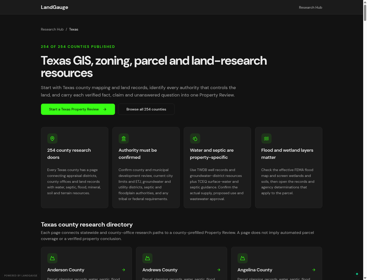
Start with the LandGauge research hub, choose your state, and open the county or local research page. The Texas directory shown above is an example; choose the location of your own property.
Depending on local coverage, the page connects you with official mapping, property records, and planning resources. Some links open a direct search tool; others lead to an office directory or a dataset that requires additional steps.
You do not need to understand every government office before starting. Begin with one question: What information am I trying to find?
How do I find my land's parcel number?
A parcel number identifies a property in a local records system. You may see it called an APN, assessor's parcel number, parcel ID, property identification number, or tax lot number. Local systems can distinguish assessment accounts from individual mapped parcels, so check how the identifier is used.
Common places to look include:
- Your property tax statement.
- Closing documents or an existing property report, if the identifier is included.
- The official assessor's property search.
- A local GIS parcel map.
If you have an address, try searching it in the official property system. Vacant land may have no assigned street address. In that case, supported map navigation can help you locate it using nearby roads and landmarks.
Before copying a parcel number, compare the mapped location, acreage, and other identifying details. A nearby search result may be a different property.
Keep the number's letters, leading zeros, and punctuation in your notes. Follow each website's instructions when entering it; some searches require punctuation to be removed. Keep the state and county or town with the identifier.
How do I find county records for my land?
Property information is often spread across several offices.
| What you need | Where to start |
|---|---|
| Parcel number and assessed property information | Assessor or property appraiser |
| Parcel map and available geographic layers | GIS or mapping department |
| Recorded deeds, plats, and easement documents | Recorder, register of deeds, or county clerk |
| Zoning and questions about a proposed use | City or county planning department |
Office names and online access vary. Some documents are searchable online; others require contacting the office or ordering a copy.
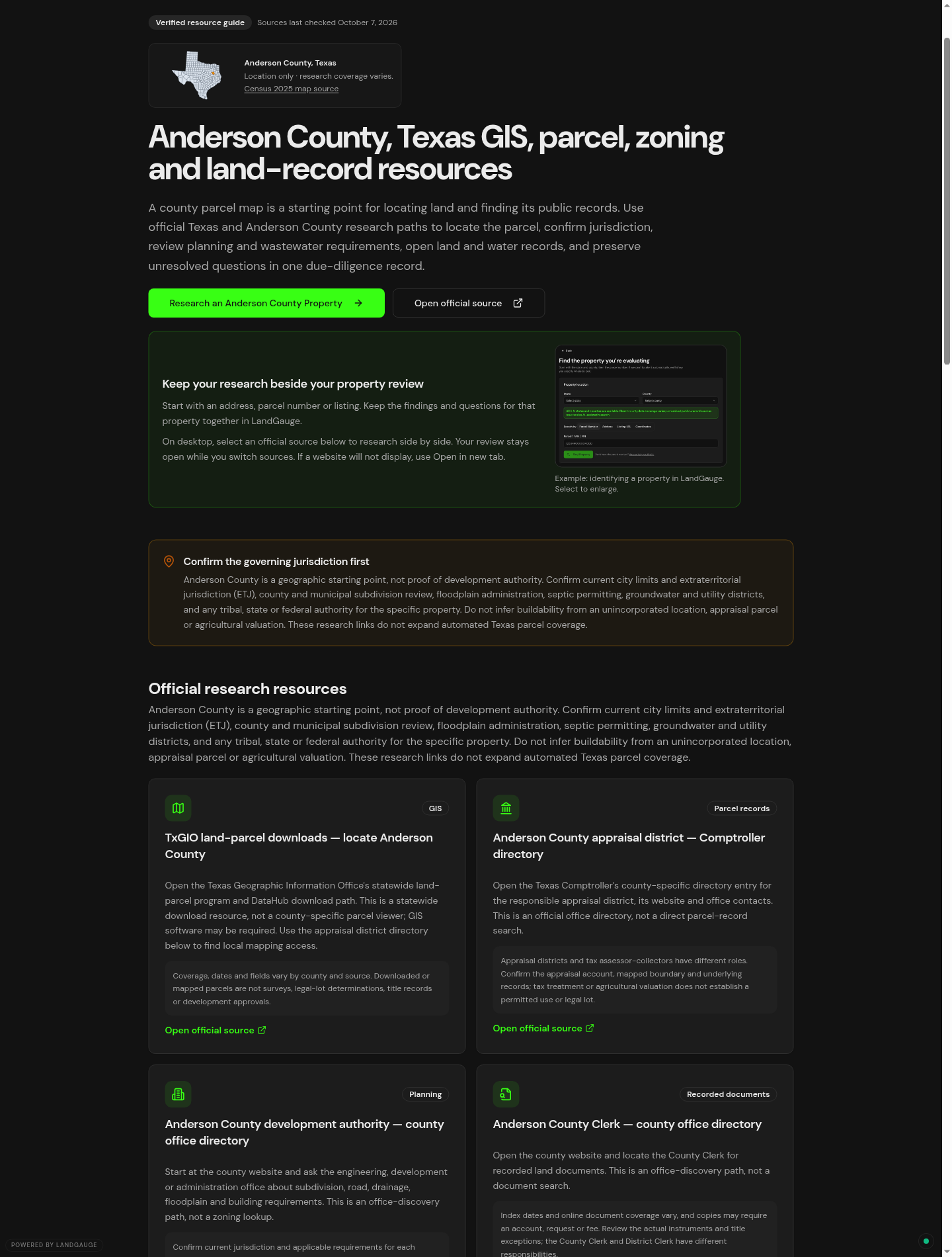
The Anderson County, Texas research page below illustrates how LandGauge groups different official research paths. Its GIS resource is a statewide parcel-download route; its office directories help you locate the responsible local services. These are different resources, rather than one universal property search.
A parcel number is useful, but recorded documents may require a recording number, legal description, or another search field. Follow the instructions for that particular records system.
For a more detailed investigation, see how to check land records before buying and how to find a deed, plat, or recorded easement.
How do I find my property on a GIS map?
GIS stands for geographic information system. For property research, think of it as a map with selectable information layers.
Open an official GIS or parcel viewer when one is available. Depending on the viewer, you may be able to search by address or parcel number, or navigate directly to the land.
- Read the viewer's search instructions.
- Enter a supported identifier, or navigate using nearby roads and landmarks.
- Select the possible parcel and compare its location and identifying details.
- Open the legend or layer menu to see what information is available.
- Follow linked reports or document references when they answer your next question.
Layers may include aerial imagery, roads, zoning, flood information, or elevation. Availability varies. Read the legend and any dates or accuracy notices; layers can come from different agencies and may be updated at different times.
For example, King County's property research guidance explains address, parcel-number, and map-based searches and separates them from other records services.
Parcel outlines are a research aid. A GIS map does not replace a boundary survey. An aerial image also does not establish legal access, recorded restrictions, or development approval.
If a search returns nothing, check the formatting, try another supported search method, or contact the responsible office. An unsuccessful search leaves a question open.
How do I find out what I can do with my land?
Finding the parcel is the beginning of that investigation.
Start by identifying which planning department governs the property. Find the zoning designation, then read the rules that apply to your intended use.
Your next questions might include:
- Can I build a home, shop, or accessory dwelling?
- Can I divide the property?
- What setbacks and minimum lot sizes apply?
- Are there recorded restrictions?
- Is legal access established?
- What water, wastewater, and power options need verification?
A zoning label or nearby building does not establish approval for your project. Ask the responsible office about your specific proposal and what additional requirements apply.
Continue with how to verify zoning on land, the buildability guide, or the land due diligence checklist, depending on your goal.
Use LandGauge to take the next step
LandGauge connects the initial lookup with a broader property investigation.
From the county research page, start a property review using the information you already have. The example below carries Texas and Anderson County into the lookup screen and shows parcel-number, address, listing-link, and coordinate search options.
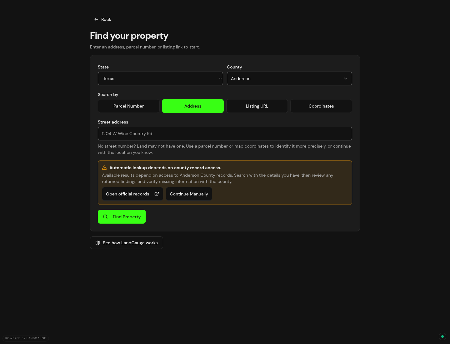
Review any returned match before relying on it. If automatic lookup is unavailable or incomplete, open official records or continue manually. Keep findings, source links, and unanswered questions connected to the property, while keeping personal and tax information in the external official systems.
You may only need a parcel number today. If your next question becomes "Could I build here?" or "Could I split this land?", you will have a clearer place to begin.
Find your county's research resources or start a LandGauge property review.
Frequently asked questions
Sources & Official Resources
Primary sources that support the information in this guide. Requirements and record systems vary by jurisdiction — always confirm with the agency responsible where the property is located.
- King County, WashingtonProperty research
An official example explaining parcel searches, assessment reports, recorded documents, and permitting resources; local systems differ.
- King County, WashingtonParcel Viewer
Official map with search guidance and a notice that lot lines are approximate and the map is not a survey product.
Related guides
- Due DiligenceLand Due Diligence: How to Check Land Records Before You BuyLearn which land records to check before buying, what maps and deeds can tell you, and which access and building questions still need verification. Includes Fremont County, Colorado examples.
- GIS & Parcel ResearchWhy County GIS and Property Searches Work DifferentlyLearn why county GIS and property searches work differently, how web and AI access vary, and the next steps when you cannot retrieve a record.
- GIS & Parcel ResearchHow to Find Your Property’s Zoning Using County GISUse LandGauge to find county GIS resources, search a parcel, locate its zoning designation, and identify what to confirm with the local planning office.
- GIS & Parcel ResearchHow to Search County Property Records Before Buying LandSearch official county property records by parcel number, confirm the property match, and identify acreage, access, and land-split questions before buying land.