Augusta County, Virginia GIS, parcel, zoning and land-record resources
A county parcel map is a starting point for locating land and finding its public records. Use Virginia and Augusta County resources to locate assessment and recorded documents, identify governing offices, and organize findings in a Property Review.
Keep your research beside your property review
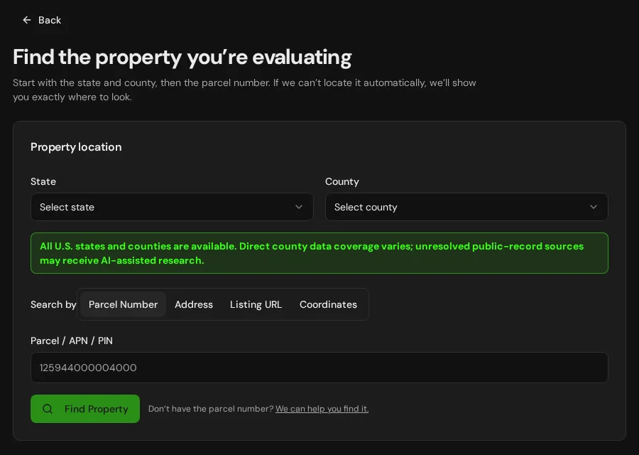
Start with an address, parcel number or listing. Keep the findings and questions for that property together in LandGauge.
On desktop, select an official source below to research side by side. Your review stays open while you switch sources. If a website will not display, use Open in new tab.
Confirm the governing jurisdiction first
Augusta County is a research starting point. Virginia's independent cities govern land separately from surrounding counties. Confirm this locality and any incorporated town's authority for assessment, zoning, subdivision, access, utilities, floodplain and development. GIS parcel shapes do not prove legal boundaries, title, access or approval.
Official research resources
Augusta County is a research starting point. Virginia's independent cities govern land separately from surrounding counties. Confirm this locality and any incorporated town's authority for assessment, zoning, subdivision, access, utilities, floodplain and development. GIS parcel shapes do not prove legal boundaries, title, access or approval.
Tap a resource to see its details, then open the official source. Use your browser’s Back or close control to return here.
GISVGIN Virginia Parcels
Screen statewide parcel geometry and available attributes, then confirm current tax and GIS records with the county.
VGIN coordinates parcel data with local governments. Check the source date, coverage and attributes; a mapped tax parcel is not a survey or a legal boundary determination.
Open official source : VGIN Virginia Parcels (opens in a new tab)Parcel recordsAugusta County real estate assessment
Use Virginia's local government directory to reach the county real estate assessor or commissioner of the revenue for current assessment records.
The state directory leads to the locality, not a direct parcel search. Confirm the assessment account and tax map number with the local office.
Open official source : Augusta County real estate assessment (opens in a new tab)PlanningAugusta County planning and zoning
Find the governing planning and zoning office through the official locality website and request rules for the exact site and proposed use.
Check incorporated town jurisdiction where applicable. A mapped zoning label does not establish legal-lot status, subdivision approval or building permission.
Open official source : Augusta County planning and zoning (opens in a new tab)Recorded documentsAugusta County circuit court land records
Find the appropriate circuit court clerk to request recorded deeds, plats, easements and restrictions for this locality.
This court directory is not a deed search. Online land-record access varies and may require registration or fees; verify actual instruments with the clerk.
Open official source : Augusta County circuit court land records (opens in a new tab)PlanningVDH onsite sewage applications
Review state application guidance and ask the local health department for existing records and property-specific permit requirements.
VDH requires supporting work from a properly licensed private sector consultant for applications, subject to stated hardship exceptions. A nearby system or soil map is not approval for this site.
Open official source : VDH onsite sewage applications (opens in a new tab)Recorded documentsVDH private well program
Review private well construction guidance and ask the local health department for the actual well permit, completion records and water testing.
Nearby well depth or yield does not establish an adequate or safe supply for this property. Confirm local permits and site-specific testing.
Open official source : VDH private well program (opens in a new tab)FloodVirginia Flood Risk Information System
Screen statewide flood layers and available reports for the parcel.
For a definitive flood-hazard determination, consult the locality floodplain administrator and effective FEMA map.
Open official source : Virginia Flood Risk Information System (opens in a new tab)FloodFEMA Map Service Center
Check effective flood insurance rate maps, studies and revisions for the exact site.
Areas outside mapped special flood hazards can still flood. Confirm the current panel and local rules.
Open official source : FEMA Map Service Center (opens in a new tab)If this source won’t open
Try opening the source in a new tab. It may be temporarily unavailable or require a browser security check.
Try FEMA’s effective flood map viewer. Confirm the panel and effective date; missing results do not establish that the property is outside a flood zone. You can also ask FEMA’s map specialists for help.
Keep this answer unknown until you can verify it. Save a note about what you still need to check. Opening a link or contacting an office does not confirm an answer.
GISNational Wetlands Inventory mapper
Screen wetlands and water features before siting buildings, access, fill or drainage work.
This is a screening layer, not a field delineation or permit decision.
Open official source : National Wetlands Inventory mapper (opens in a new tab)PlanningVirginia DEQ wetlands and streams
Review Virginia Water Protection permit requirements before disturbing wetlands or streams.
Confirm jurisdiction and permitting for the proposed work. In Tidewater Virginia, ask the locality whether Chesapeake Bay Preservation Areas or Resource Protection Areas also affect the site.
Open official source : Virginia DEQ wetlands and streams (opens in a new tab)TerrainNRCS Web Soil Survey
Screen soils, drainage and limitations for onsite wastewater, foundations and roads.
Soil mapping does not replace a licensed onsite evaluation or engineering review.
Open official source : NRCS Web Soil Survey (opens in a new tab)TerrainUSGS National Map
Review slope, elevation and drainage context around the site.
Displayed roads and contours do not establish legal access or a buildable envelope.
Open official source : USGS National Map (opens in a new tab)FEMA Map Service Center
Check effective flood insurance rate maps, studies and revisions for the exact site.
Areas outside mapped special flood hazards can still flood. Confirm the current panel and local rules.
Open official sourceIf this source won’t open
Try opening the source in a new tab. It may be temporarily unavailable or require a browser security check.
Try FEMA’s effective flood map viewer. Confirm the panel and effective date; missing results do not establish that the property is outside a flood zone. You can also ask FEMA’s map specialists for help.
Keep this answer unknown until you can verify it. Save a note about what you still need to check. Opening a link or contacting an office does not confirm an answer.
A practical Augusta County research sequence
Locality and court directories are starting points. Zoning, deeds, septic, wells, flood, wetlands and access require current property-specific evidence.
- 1
Confirm the parcel and assessor
Screen VGIN parcels, then find the locality assessment or GIS office through Virginia’s government directory. Confirm the current tax map ID and record, then compare mapped shapes with deeds and a survey.
- 2
Ask who governs land use
Check county, independent city or incorporated town zoning, subdivision, roads, utilities, floodplain and Bay Act requirements where relevant.
- 3
Collect records and septic evidence
Request deeds, plats and easements from the circuit court clerk. Ask the local health department about onsite sewage evaluations and permits.
- 4
Check water and mapped constraints
Review private well rules, effective flood mapping, wetlands, Bay Act protections where applicable, soils and terrain; obtain site-specific confirmation.
Why Augusta County research still requires manual verification
VGIN aggregates local parcel data, while current assessment and court recording access vary by locality. Some records require registration, payment, a call or an in-person request. Confirm the current record, authority and site conditions.
Augusta County, Virginia GIS and zoning questions
Where can I find Augusta County parcel information?
Screen VGIN’s statewide parcel layer, then use Virginia’s local government directory to reach the locality assessor for current records. Neither source proves boundaries or adds automated LandGauge parcel coverage.
Does a tax parcel map prove the land can be built on or split?
No. Verify legal boundaries and access, then ask the governing locality or town about legal-lot status, zoning, subdivision, roads, utilities and permits.
Where can I obtain deeds, plats and easements?
Find the circuit court clerk through the Virginia Court System directory. Request the actual instruments and confirm dates, access and fees.
Who handles residential septic permits?
VDH handles onsite sewage permits through local health departments, with supporting private sector work generally required under state guidance. Obtain property-specific evaluation and permit records before relying on a proposed system.
Can a nearby well prove the parcel has water?
No. Contact the local health department about private well permitting and records. Confirm the actual well construction, water quality and supply for this site.
Does an empty flood or wetland map clear the site?
No. Check effective FEMA mapping and local floodplain rules, seek field review of wetlands, and ask the locality about Chesapeake Bay Preservation Areas where relevant.
Turn the research into a property record
Start with Virginia and Augusta County preselected. Add an address, parcel number or listing URL, then organize official findings, seller claims and open questions in one Property Review.
Start the Property ReviewLandGauge organizes research starting points. County and map information may change and does not replace a survey, title examination, engineering review, floodplain determination, permit decision or professional advice.