Panola County, Texas GIS, parcel, zoning and land-record resources
A county parcel map is a starting point for locating land and finding its public records. Use official Texas and Panola County research paths to locate the parcel, confirm jurisdiction, review planning and wastewater requirements, open land and water records, and preserve unresolved questions in one due-diligence record.
Keep your research beside your property review
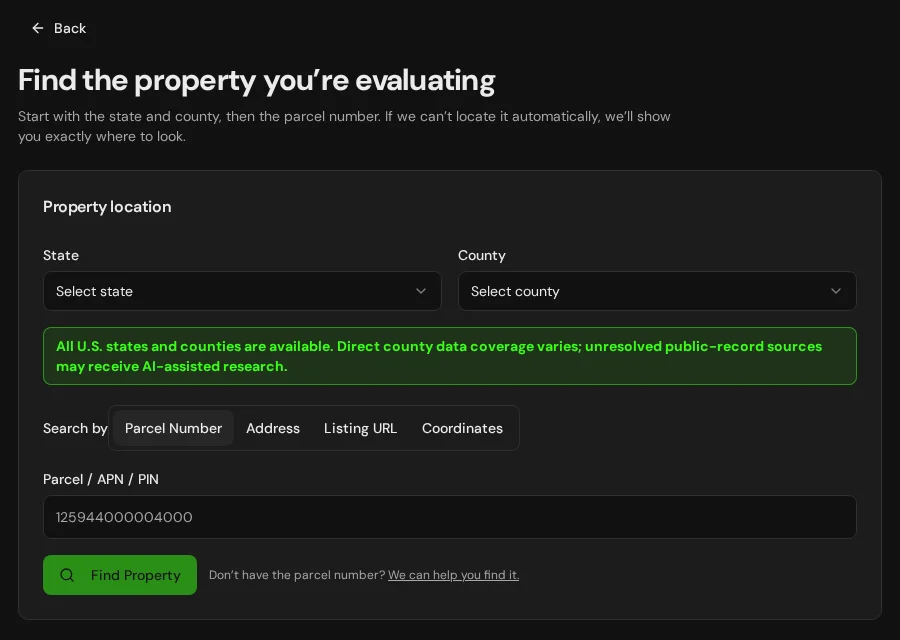
Start with an address, parcel number or listing. Keep the findings and questions for that property together in LandGauge.
On desktop, select an official source below to research side by side. Your review stays open while you switch sources. If a website will not display, use Open in new tab.
Confirm the governing jurisdiction first
Panola County is a geographic starting point, not proof of development authority. Confirm current city limits and extraterritorial jurisdiction (ETJ), county and municipal subdivision review, floodplain administration, septic permitting, groundwater and utility districts, and any tribal, state or federal authority for the specific property. Do not infer buildability from an unincorporated location, appraisal parcel or agricultural valuation. These research links do not expand automated Texas parcel coverage.
Official research resources
Panola County is a geographic starting point, not proof of development authority. Confirm current city limits and extraterritorial jurisdiction (ETJ), county and municipal subdivision review, floodplain administration, septic permitting, groundwater and utility districts, and any tribal, state or federal authority for the specific property. Do not infer buildability from an unincorporated location, appraisal parcel or agricultural valuation. These research links do not expand automated Texas parcel coverage.
Tap a resource to see its details, then open the official source. Use your browser’s Back or close control to return here.
GISTxGIO land-parcel downloads — locate Panola County
Open the Texas Geographic Information Office's statewide land-parcel program and DataHub download path. This is a statewide download resource, not a county-specific parcel viewer; GIS software may be required. Use the appraisal district directory below to find local mapping access.
Coverage, dates and fields vary by county and source. Downloaded or mapped parcels are not surveys, legal-lot determinations, title records or development approvals.
Open official source : TxGIO land-parcel downloads — locate Panola County (opens in a new tab)Parcel recordsPanola County appraisal district — Comptroller directory
Open the Texas Comptroller's county-specific directory entry for the responsible appraisal district, its website and office contacts. This is an official office directory, not a direct parcel-record search.
Appraisal districts and tax assessor-collectors have different roles. Confirm the appraisal account, mapped boundary and underlying records; tax treatment or agricultural valuation does not establish a permitted use or legal lot.
Open official source : Panola County appraisal district — Comptroller directory (opens in a new tab)PlanningPanola County development authority — county office directory
Start at the county website and ask the engineering, development or administration office about subdivision, road, drainage, floodplain and building requirements. This is an office-discovery path, not a zoning lookup.
Confirm current jurisdiction and applicable requirements for each decision, including city limits and ETJ status. Do not assume every county has general zoning or that land outside a city is unrestricted.
Open official source : Panola County development authority — county office directory (opens in a new tab)Recorded documentsPanola County Clerk — county office directory
Open the county website and locate the County Clerk for recorded land documents. This is an office-discovery path, not a document search.
Index dates and online document coverage vary, and copies may require an account, request or fee. Review the actual instruments and title exceptions; the County Clerk and District Clerk have different responsibilities.
Open official source : Panola County Clerk — county office directory (opens in a new tab)PlanningTCEQ on-site sewage facilities (OSSF)
Find septic-system guidance and the responsible permitting authority through the Texas Commission on Environmental Quality's homeowner resources.
Confirm the authorized agent or TCEQ reviewer, site evaluation, soils, system design, setbacks and approvals for the actual use. Acreage alone does not establish septic feasibility or an exemption.
Open official source : TCEQ on-site sewage facilities (OSSF) (opens in a new tab)Recorded documentsTWDB groundwater and water-well records
Use the Texas Water Development Board's groundwater-data resources to reach well records, submitted driller reports, water levels and the interactive viewer.
A nearby well or historical log does not establish present yield, water quality, a shared-well right or drilling permission. Verify the actual supply, tests, condition and proposed use.
Open official source : TWDB groundwater and water-well records (opens in a new tab)PlanningTWDB groundwater conservation district directory
Identify groundwater conservation districts and follow their official information and contact paths.
District boundaries do not necessarily follow county lines and do not cover every property. Confirm any registration, permit, spacing, production, transfer or special-authority requirements with the responsible district or agency.
Open official source : TWDB groundwater conservation district directory (opens in a new tab)Recorded documentsTCEQ surface-water rights and permits
Find state-water permitting, amendments and ownership-change research through TCEQ.
A pond, creek, deed reference or nearby water source does not establish an authorized supply. Confirm the actual right, purpose, place, quantity, current status and any exemption or change with the responsible authority.
Open official source : TCEQ surface-water rights and permits (opens in a new tab)PlanningTCEQ water districts viewer
Screen water-district boundaries and follow links to the Integrated Water Districts Database for district information.
Mapped district membership does not guarantee utility service, available capacity or affordable connection. Confirm the service provider, district obligations, fees, easements and extension requirements directly.
Open official source : TCEQ water districts viewer (opens in a new tab)GISRailroad Commission oil, gas and pipeline GIS
Use the Railroad Commission of Texas's public GIS resources to investigate mapped wells, oil and gas activity and pipelines.
The viewer does not establish mineral ownership, all easements, exact field locations or safe excavation clearance. Research surface and mineral title, leases and recorded agreements separately and verify site conditions.
Open official source : Railroad Commission oil, gas and pipeline GIS (opens in a new tab)FloodFEMA Flood Map Service Center
Locate the effective FEMA flood map (FIRM) and Letters of Map Change for the property.
Confirm the effective map and requirements with the local floodplain administrator. Planning layers do not replace the effective FIRM, and an unmapped area is not evidence of no flood risk.
Open official source : FEMA Flood Map Service Center (opens in a new tab)If this source won’t open
Try opening the source in a new tab. It may be temporarily unavailable or require a browser security check.
Try FEMA’s effective flood map viewer. Confirm the panel and effective date; missing results do not establish that the property is outside a flood zone. You can also ask FEMA’s map specialists for help.
Keep this answer unknown until you can verify it. Save a note about what you still need to check. Opening a link or contacting an office does not confirm an answer.
GISNational Wetlands Inventory mapper
Screen mapped wetlands and water features that may affect building areas, drainage and access.
NWI is a screening layer, not a jurisdictional delineation or permit decision. Confirm field conditions and agency requirements for the proposed activity.
Open official source : National Wetlands Inventory mapper (opens in a new tab)TerrainNRCS Web Soil Survey
Screen soil types, drainage and potential limitations for septic systems, roads and foundations.
Regional soil ratings do not replace an on-site soil evaluation, septic design or engineering review.
Open official source : NRCS Web Soil Survey (opens in a new tab)Recorded documentsBIA Land Titles and Records Offices
Identify the office of record when the property may involve trust, restricted or allotted Indian land.
A county or reservation boundary does not settle parcel land status. Confirm title evidence and the responsible tribal and federal authorities for the specific decision.
Open official source : BIA Land Titles and Records Offices (opens in a new tab)TerrainUSGS National Map
Screen elevation, contours, drainage and terrain context around the property.
A mapped road does not establish legal access or public maintenance. Confirm easements, road authority, seasonal conditions and site constraints separately.
Open official source : USGS National Map (opens in a new tab)PlanningTCEQ Edwards Aquifer regulated-zone screening
Where relevant, use the official viewer to determine whether the property intersects an Edwards Aquifer Protection Program regulated zone.
This regional program does not apply statewide or to every parcel in a listed county. Confirm the actual mapped zone, project activity and required review with TCEQ; it is separate from groundwater-use permitting.
Open official source : TCEQ Edwards Aquifer regulated-zone screening (opens in a new tab)PlanningGLO coastal beach access and dune protection
For coastal property, find local beach-access plans and guidance on beachfront construction certificates and dune protection permits.
These are regional resources, not restrictions on every Texas parcel. Confirm the property's shoreline context, public access, applicable local plan and agency approvals before relying on a proposed building area.
Open official source : GLO coastal beach access and dune protection (opens in a new tab)FEMA Flood Map Service Center
Locate the effective FEMA flood map (FIRM) and Letters of Map Change for the property.
Confirm the effective map and requirements with the local floodplain administrator. Planning layers do not replace the effective FIRM, and an unmapped area is not evidence of no flood risk.
Open official sourceIf this source won’t open
Try opening the source in a new tab. It may be temporarily unavailable or require a browser security check.
Try FEMA’s effective flood map viewer. Confirm the panel and effective date; missing results do not establish that the property is outside a flood zone. You can also ask FEMA’s map specialists for help.
Keep this answer unknown until you can verify it. Save a note about what you still need to check. Opening a link or contacting an office does not confirm an answer.
A practical Panola County research sequence
County mapping and statewide water, flood, wetland and soil resources are valuable starting points, but land-use, platting, recording, septic, water, access and jurisdiction questions still require property-specific confirmation.
- 1
Locate the parcel and confirm the governing authority
Start with the appraisal district and official mapping resources. Confirm current city limits and ETJ, county and municipal subdivision review, floodplain and septic authorities, groundwater and utility districts, and any tribal, state or federal authority.
- 2
Verify zoning, subdivision and wastewater requirements
Confirm allowed uses, setbacks, minimum parcel size, plat procedure, road and approach standards, building requirements and who reviews on-site wastewater for the property.
- 3
Open the underlying land and water records
Review the current deed, plat, survey, easements, covenants, title exceptions, well records, water-use permits and changes of use, oil and gas records, mineral reservations and any trust or restricted land-status records.
- 4
Verify physical, flood and access constraints
Investigate legal and physical access, road authority, utilities, wells, septic feasibility, the effective FEMA flood map, wetlands, soils, drainage, terrain and seasonal conditions.
Why Panola County research still requires manual verification
Current deeds, plats, surveys, easements, subdivision files, septic approvals, water rights, well records, mineral reservations, trust land-status records and planning decisions may require email, a phone call, payment, registration or an in-person request. Access, water, wastewater, flood, wetland, jurisdiction and buildability conclusions require property-specific evidence.
Panola County, Texas GIS and zoning questions
Where is the official Panola County, Texas parcel map?
Use the official mapping link where listed, or follow the county-specific Comptroller directory to the appraisal district for available parcel maps. TxGIO provides statewide GIS downloads with varying source dates. Contact the Panola County appraisal district and confirm the parcel identifier, legal description and acreage with appraisal records, recorded instruments and the County Clerk. A parcel map is not a survey or title record.
Does a Texas tax parcel prove I can build or split the land?
No. A tax parcel or mapped boundary is not a plat approval, legal-access determination, survey, septic approval or building permit. Confirm current city limits and ETJ, subdivision and road review, deed restrictions, groundwater and utility districts, septic, floodplain and other applicable requirements. An unincorporated location or agricultural valuation does not establish unrestricted use.
How do overlapping authorities affect Panola County?
Confirm the actual county, municipal, ETJ, groundwater-district and utility-district boundaries and each office's role. Where Indian land is involved, county or reservation boundaries alone do not settle fee, trust, restricted or allotted status; use title evidence and the responsible tribal and BIA offices.
How do I check wells, water rights, septic and flood risk?
Use TWDB well records and groundwater-district resources, TCEQ surface-water and on-site sewage guidance, and the effective FEMA flood map. Confirm the actual water source, district and agency requirements, proposed use, soil evaluation and approvals for the property.
How do minerals, aquifer zones and the coast affect research?
Research surface and mineral interests separately using recorded instruments and title evidence; RRC maps help screen wells and pipelines. Where relevant, check TCEQ Edwards Aquifer regulated zones and GLO coastal resources. Those regional programs do not apply to every Texas parcel, and map screening does not establish approval.
Why check wetlands and soils in Texas?
Wetlands, floodplain drainage, conservation easements and soil limitations can restrict building sites, drainage and septic systems. Treat the National Wetlands Inventory and Web Soil Survey as screening leads, then confirm with the responsible agencies and on-site evaluation.
Turn the research into a property record
Start with Texas and Panola County preselected. Add the address, parcel number or listing URL, then save official findings, seller claims and unresolved questions in one Property Review.
Start the Property ReviewLandGauge organizes research starting points. County and map information may change and does not replace a survey, title examination, engineering review, floodplain determination, permit decision or professional advice.