Sully County, South Dakota GIS, parcel, zoning and land-record resources
A county parcel map is a starting point for locating land and finding its public records. Use official South Dakota and Sully County research paths to locate the parcel, confirm jurisdiction, review planning and wastewater requirements, open land and water records, and preserve unresolved questions in one due-diligence record.
Keep your research beside your property review
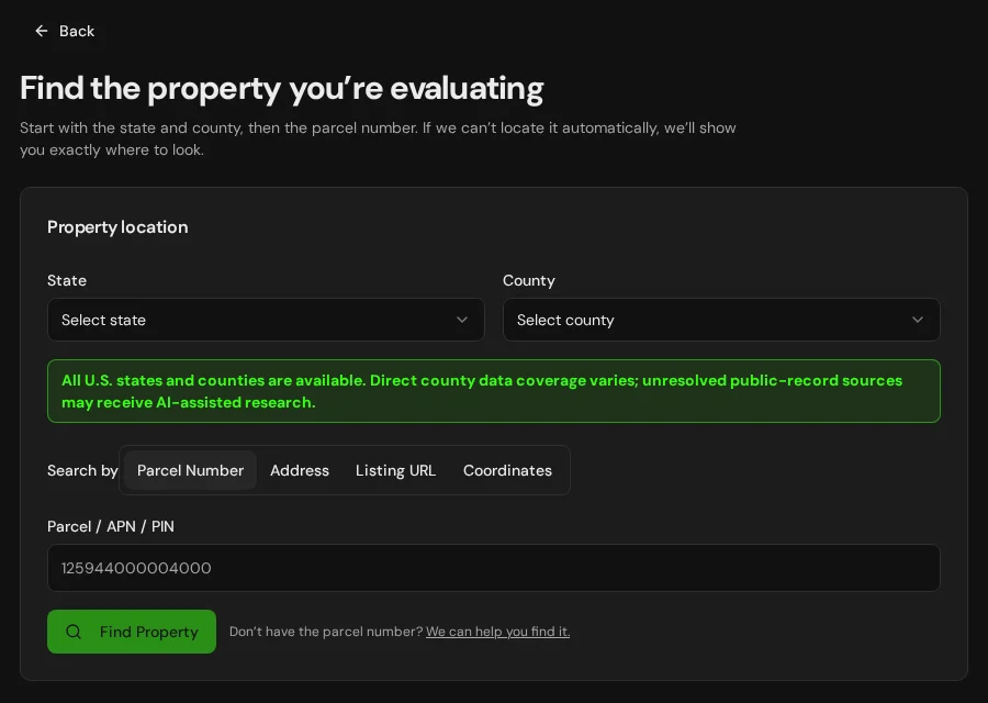
Start with an address, parcel number or listing. Keep the findings and questions for that property together in LandGauge.
On desktop, select an official source below to research side by side. Your review stays open while you switch sources. If a website will not display, use Open in new tab.
Confirm the governing jurisdiction first
Sully County is a geographic starting point, not proof of land-use or permitting authority. Confirm county versus city or town jurisdiction, township or joint zoning arrangements, tribal trust or allotted-land status, and any state or federal authority. This page is an official-resource research path and does not claim automated South Dakota parcel coverage.
Official research resources
Sully County is a geographic starting point, not proof of land-use or permitting authority. Confirm county versus city or town jurisdiction, township or joint zoning arrangements, tribal trust or allotted-land status, and any state or federal authority. This page is an official-resource research path and does not claim automated South Dakota parcel coverage.
Tap a resource to see its details, then open the official source. Use your browser’s Back or close control to return here.
GISSully County official website and GIS starting point
Use the South Dakota Association of County Officials county list to open the county's own website, where many counties link their parcel map or GIS viewer.
South Dakota publishes parcel data county by county. Some counties do not maintain a website or public parcel map; contact the county directly. Mapped lines and acreage are not a survey.
Open official source : Sully County official website and GIS starting point (opens in a new tab)Parcel recordsSully County Director of Equalization
Use the Department of Revenue contact list to reach the county Director of Equalization for assessment records, parcel identifiers and legal descriptions.
Assessment records support research but do not establish title, legal access, buildability or development approval.
Open official source : Sully County Director of Equalization (opens in a new tab)PlanningSully County planning and zoning contact
Use the county website to locate Planning and Zoning or the county office that administers land use, subdivision plats and building permits.
Not every South Dakota county administers zoning the same way, and cities and towns control land inside their limits. Confirm county, municipal, township, tribal and state authority; a tax parcel is not a building or subdivision approval.
Open official source : Sully County planning and zoning contact (opens in a new tab)Recorded documentsSully County Register of Deeds and property records
Use the county website to reach the Register of Deeds for deeds, plats, surveys, easements, covenants and other recorded instruments.
Obtain the underlying instruments and title exceptions. A map line, road, section line or index entry does not prove surveyed boundaries or legal access.
Open official source : Sully County Register of Deeds and property records (opens in a new tab)PlanningSouth Dakota on-site wastewater requirements
Review the Department of Agriculture and Natural Resources septic system requirements, plan checklist and ARSD 74:53:01 rules.
Some counties and cities add local septic permits or setbacks. Confirm soils, percolation, depth to groundwater or bedrock, separation distances, design and the responsible local or state reviewer; an existing system does not approve another dwelling or lot.
Open official source : South Dakota on-site wastewater requirements (opens in a new tab)Recorded documentsSouth Dakota well completion reports
Search well logs and completion reports through the Department of Agriculture and Natural Resources Water Rights Program.
A nearby well or driller's log does not prove reliable yield, potable quality, a shared-well right or permission to drill. Tie the actual well and records to the property and proposed use.
Open official source : South Dakota well completion reports (opens in a new tab)Recorded documentsSouth Dakota water rights and permits
Search water-right permits, licenses and related records through the Water Rights Program databases.
Confirm the actual right holder, priority, source, place and purpose of use, status and transfer requirements. Domestic-use exemptions and surface ownership do not by themselves establish a usable water supply.
Open official source : South Dakota water rights and permits (opens in a new tab)FloodFEMA Flood Map Service Center
Look up the effective FEMA flood map (FIRM) and any Letters of Map Change for the property.
Use the effective FIRM for regulatory flood status and confirm with the local floodplain administrator. Screening or planning layers are not regulatory maps, and an unmapped area is not proof of no flood risk.
Open official source : FEMA Flood Map Service Center (opens in a new tab)If this source won’t open
Try opening the source in a new tab. It may be temporarily unavailable or require a browser security check.
Try FEMA’s effective flood map viewer. Confirm the panel and effective date; missing results do not establish that the property is outside a flood zone. You can also ask FEMA’s map specialists for help.
Keep this answer unknown until you can verify it. Save a note about what you still need to check. Opening a link or contacting an office does not confirm an answer.
GISNational Wetlands Inventory mapper
Screen mapped wetlands, prairie potholes and water features that may constrain use.
NWI mapping is a screening tool, not a jurisdictional delineation. Farmed-wetland determinations, easements and permits require confirmation with the responsible federal and state agencies.
Open official source : National Wetlands Inventory mapper (opens in a new tab)TerrainNRCS Web Soil Survey
Screen soil types, drainage, depth to water table and septic-absorption limitations.
Soil survey ratings are general. Septic suitability and foundations require on-site percolation, soil and engineering evaluation.
Open official source : NRCS Web Soil Survey (opens in a new tab)Recorded documentsBIA Great Plains Land Titles and Records Office
Contact the federal office of record for trust and restricted Indian land titles in South Dakota.
Use when a parcel may be trust, restricted or allotted land. A reservation boundary on a map does not determine land status or jurisdiction.
Open official source : BIA Great Plains Land Titles and Records Office (opens in a new tab)GISSouth Dakota DOT maps
Screen state highways, county maps and transportation context through SDDOT.
A mapped road does not establish legal access or public maintenance. Confirm access rights, section-line status, approach permits and road authority for the property.
Open official source : South Dakota DOT maps (opens in a new tab)TerrainUSGS National Map
Screen elevation, contours, drainage, public-land and terrain context.
Regional data does not replace a survey, geotechnical work or site investigation. Check drainage, frost, seasonal access and construction conditions separately.
Open official source : USGS National Map (opens in a new tab)FEMA Flood Map Service Center
Look up the effective FEMA flood map (FIRM) and any Letters of Map Change for the property.
Use the effective FIRM for regulatory flood status and confirm with the local floodplain administrator. Screening or planning layers are not regulatory maps, and an unmapped area is not proof of no flood risk.
Open official sourceIf this source won’t open
Try opening the source in a new tab. It may be temporarily unavailable or require a browser security check.
Try FEMA’s effective flood map viewer. Confirm the panel and effective date; missing results do not establish that the property is outside a flood zone. You can also ask FEMA’s map specialists for help.
Keep this answer unknown until you can verify it. Save a note about what you still need to check. Opening a link or contacting an office does not confirm an answer.
A practical Sully County research sequence
South Dakota's county parcel maps and statewide water, flood, wetland and soil resources are valuable starting points, but land-use, platting, recording, septic, water, access and jurisdiction questions still require property-specific confirmation.
- 1
Locate the parcel and confirm the governing authority
Start with the county website and Director of Equalization, then determine whether the county, a city or town, a township, a tribe, or a state or federal agency controls the question.
- 2
Verify zoning, subdivision and wastewater requirements
Confirm allowed uses, setbacks, minimum parcel size, plat procedure, road and approach standards, building requirements and who reviews on-site wastewater for the property.
- 3
Open the underlying land and water records
Review the current deed, plat, survey, easements, covenants, title exceptions, well completion reports, water rights, mineral reservations and any trust or restricted land-status records.
- 4
Verify physical, flood and access constraints
Investigate legal and physical access, section lines, utilities, wells, septic feasibility, the effective FEMA flood map, wetlands, soils, drainage, terrain and seasonal conditions.
Why Sully County research still requires manual verification
Current deeds, plats, surveys, easements, subdivision files, septic approvals, water rights, mineral reservations, trust land-status records and planning decisions may require email, a phone call, payment, registration or an in-person request. Access, water, wastewater, flood, wetland, jurisdiction and buildability conclusions require property-specific evidence.
Sully County, South Dakota GIS and zoning questions
Where is the official Sully County, South Dakota parcel map?
South Dakota publishes parcel data county by county. Open the county website from the South Dakota Association of County Officials list on this page and use its parcel map if one is offered, then confirm the parcel identifier, legal description and acreage with the Director of Equalization and Register of Deeds. A parcel map is not a survey or title record.
Does a South Dakota tax parcel prove I can build or split the land?
No. A tax parcel or mapped boundary is not a plat approval, legal-access determination, survey, septic approval or building permit. Confirm every county, municipal, township, tribal and state requirement for the proposed use.
How do tribal and local jurisdiction affect Sully County?
A county location or reservation boundary does not determine fee, trust, restricted or allotted status and does not identify every permitting authority. Confirm the parcel's land status with title evidence, the county and the BIA Great Plains Land Titles and Records Office, and confirm which county, municipal, tribal, state and federal offices decide each question.
How do I check wells, water rights, septic and flood risk?
Use the DANR well completion reports and water-rights databases, the DANR on-site wastewater requirements plus any county or city septic rules, and the FEMA Flood Map Service Center for the effective flood map. Tie each record and requirement to the parcel and proposed use.
Why check wetlands and soils in South Dakota?
Prairie potholes, farmed wetlands, conservation easements and soil limitations can restrict building sites, drainage and septic systems. Treat the National Wetlands Inventory and Web Soil Survey as screening leads, then confirm with the responsible agencies and on-site evaluation.
Turn the research into a property record
Start with South Dakota and Sully County preselected. Add the address, parcel number or listing URL, then save official findings, seller claims and unresolved questions in one Property Review.
Start the Property ReviewLandGauge organizes research starting points. County and map information may change and does not replace a survey, title examination, engineering review, floodplain determination, permit decision or professional advice.