West Carroll Parish, Louisiana GIS, parcel, zoning and land-record resources
A county parcel map is a starting point for locating land and finding its public records. Use Louisiana and West Carroll Parish research paths to locate the property, identify the controlling offices, investigate flood and coastal constraints, and keep findings and unanswered questions in one Property Review.
Keep your research beside your property review
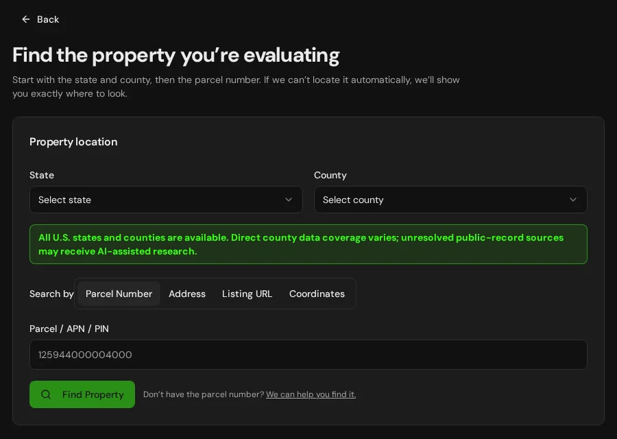
Start with an address, parcel number or listing. Keep the findings and questions for that property together in LandGauge.
On desktop, select an official source below to research side by side. Your review stays open while you switch sources. If a website will not display, use Open in new tab.
Confirm the governing jurisdiction first
West Carroll Parish is a geographic starting point, not proof of development authority. Confirm whether the site is inside an incorporated municipality or unincorporated parish territory and identify the planning, subdivision, road, drainage, floodplain, onsite wastewater, water-well and coastal authorities. Assessment or agricultural classification is not zoning. These pages do not add automatic Louisiana parcel lookup or establish buildability.
Official research resources
West Carroll Parish is a geographic starting point, not proof of development authority. Confirm whether the site is inside an incorporated municipality or unincorporated parish territory and identify the planning, subdivision, road, drainage, floodplain, onsite wastewater, water-well and coastal authorities. Assessment or agricultural classification is not zoning. These pages do not add automatic Louisiana parcel lookup or establish buildability.
Tap a resource to see its details, then open the official source. Use your browser’s Back or close control to return here.
GISWest Carroll Parish assessor and parcel search — office-discovery starting point
Use the Louisiana Assessors' Association parish directory to locate the official assessor and current property-search or mapping entry point.
This is a directory fallback, not a direct parcel query. Availability, dates and attributes vary by assessor. Assessment maps are not surveys, title opinions, legal-access evidence, coastal determinations or zoning decisions.
Open official source : West Carroll Parish assessor and parcel search — office-discovery starting point (opens in a new tab)Parcel recordsWest Carroll Parish government offices
Use the Police Jury Association parish directory to locate the parish governing authority and official website, then identify planning, public works, drainage, sewerage and floodplain contacts.
Louisiana parishes use police-jury, council, commission or consolidated forms of government. Confirm the current office and its responsibility for the specific record or decision. A tax record does not establish ownership, access or permission to build.
Open official source : West Carroll Parish government offices (opens in a new tab)PlanningWest Carroll Parish planning and jurisdiction — office-discovery starting point
Start with the parish directory, then identify the parish, consolidated government or incorporated municipality that administers zoning, subdivision, building, road, drainage and floodplain requirements.
This is not a direct zoning lookup. Louisiana land-use administration is local and may differ inside municipal limits. Verify the current ordinance, zoning map, legal-lot status and reviewing office, and obtain written property-specific answers.
Open official source : West Carroll Parish planning and jurisdiction — office-discovery starting point (opens in a new tab)Recorded documentsWest Carroll Parish conveyance and mortgage records
Use the Louisiana Clerks' Remote Access Authority portal and the parish Clerk of Court to locate conveyance, mortgage, plat, lien, easement and other recorded land documents.
Participation, registration, fees, images and historical coverage vary by parish, and Orleans can use specialized records systems. Search results are not title opinions. Obtain and interpret the actual instruments and confirm the legal description and encumbrances.
Open official source : West Carroll Parish conveyance and mortgage records (opens in a new tab)Recorded documentsLouisiana Office of State Lands historical records
Research official township plats, field notes, tract books, state patents and related State Land Office documents.
These historical and state-land records are not a current parish conveyance search, private boundary survey or title examination. Confirm current ownership, boundary evidence, water-bottom questions and recorded instruments separately.
Open official source : Louisiana Office of State Lands historical records (opens in a new tab)PlanningLouisiana individual onsite wastewater permits
Use Louisiana Department of Health permit guidance for individual sewage treatment systems and contact the responsible parish health unit or sanitarian.
Confirm public sewer availability, site and soil conditions, licensed installation, treatment type, discharge or disposal method, permits, setbacks, maintenance and approval for the actual proposal. An existing system does not approve a split or added dwelling.
Open official source : Louisiana individual onsite wastewater permits (opens in a new tab)PlanningLouisiana C&E Water Administration
Review current aquifer information and water-administration authority contacts, then confirm the responsible office for parcel-specific well requirements.
The Department of Conservation and Energy transition may move resources between current and archive sites. Confirm current registration, driller, construction, testing, setback and plugging requirements. A nearby well does not establish adequate yield or water quality.
Open official source : Louisiana C&E Water Administration (opens in a new tab)Recorded documentsLouisiana SONRIS water-well and natural-resource records
Use the Department of Conservation and Energy SONRIS guides to search registered water wells and related state natural-resource records.
Available registrations do not prove every well is shown, accurately located or still in use. A missing record does not prove there is no well. Confirm field conditions, completion or plugging records, yield, aquifer and water testing.
Open official source : Louisiana SONRIS water-well and natural-resource records (opens in a new tab)FloodLouisiana NFIP and local floodplain administration
Use Louisiana DOTD's National Flood Insurance Program resources and identify the parish or municipal floodplain administrator responsible for the site.
Confirm the effective FEMA map, base flood elevation, floodway or coastal-high-hazard status, Letters of Map Change, local freeboard and the actual administrator's development review. Flood insurance and permit standards are separate questions.
Open official source : Louisiana NFIP and local floodplain administration (opens in a new tab)FloodFEMA Flood Map Service Center
Locate the effective Flood Insurance Rate Map and Letters of Map Change for the property.
A screening layer or location outside a mapped high-risk zone is not evidence of no flood risk. Louisiana sites can face riverine, rainfall, drainage, storm-surge and levee-related hazards that require separate evidence.
Open official source : FEMA Flood Map Service Center (opens in a new tab)If this source won’t open
Try opening the source in a new tab. It may be temporarily unavailable or require a browser security check.
Try FEMA’s effective flood map viewer. Confirm the panel and effective date; missing results do not establish that the property is outside a flood zone. You can also ask FEMA’s map specialists for help.
Keep this answer unknown until you can verify it. Save a note about what you still need to check. Opening a link or contacting an office does not confirm an answer.
PlanningLouisiana C&E Office of Permitting and Compliance
Find the current coastal permitting authority and contacts. Confirm current requirements before relying on archived coastal-use guidance.
Confirm whether the parcel and proposed work are within the coastal zone and which state, local or federal reviews apply. An agency contact or application does not establish permit approval.
Open official source : Louisiana C&E Office of Permitting and Compliance (opens in a new tab)PlanningLouisiana coastal-use permit guidance (archive)
Review archived state coastal-use permit guidance for work that may affect coastal waters, including dredge or fill, water-control structures, bulkheads, facilities and residential development.
First confirm whether the parcel and proposed work are within Louisiana's coastal zone and which state, local or federal reviews apply. Submitting an application does not itself establish that a permit is required or approved.
Open official source : Louisiana coastal-use permit guidance (archive) (opens in a new tab)FloodLouisiana Coastal Master Plan Data Viewer
Screen modeled coastal land change, storm-surge flood risk and restoration or risk-reduction projects over the planning horizon.
Master Plan scenarios are planning models, not parcel-scale elevation surveys, effective FEMA maps, permit decisions or guarantees of future conditions. Compare them with current local, state and federal evidence.
Open official source : Louisiana Coastal Master Plan Data Viewer (opens in a new tab)GISLouisiana SONRIS oil and gas well locations
Screen the official state oil and gas well layer for available permitted-well location and status context near the property.
Mapped points and database status are screening evidence, not a field survey or proof that all wells, flowlines, pipelines, pits, servitudes or legacy conditions are absent. Confirm title, agency and site records and obtain specialist review when warranted.
Open official source : Louisiana SONRIS oil and gas well locations (opens in a new tab)GISNational Wetlands Inventory mapper
Screen mapped wetlands and water features that may affect building areas, drainage, access and federal review.
NWI is a screening layer, not a field delineation, jurisdictional decision or permit. Confirm actual conditions and applicable federal, state, coastal and local requirements.
Open official source : National Wetlands Inventory mapper (opens in a new tab)TerrainNRCS Web Soil Survey
Screen soil types, drainage, farmland classifications and potential limitations for wastewater, roads, foundations and wet-site development.
Mapped soil information does not replace an on-site soil evaluation, wastewater design, wetland delineation, elevation survey, geotechnical work or engineering.
Open official source : NRCS Web Soil Survey (opens in a new tab)TerrainUSGS National Map
Screen elevation, contours, hydrography and terrain context around the property.
Low-relief coastal terrain requires appropriate elevation data and surveying. A mapped road or levee does not establish legal access, public maintenance, protection level or development approval.
Open official source : USGS National Map (opens in a new tab)FEMA Flood Map Service Center
Locate the effective Flood Insurance Rate Map and Letters of Map Change for the property.
A screening layer or location outside a mapped high-risk zone is not evidence of no flood risk. Louisiana sites can face riverine, rainfall, drainage, storm-surge and levee-related hazards that require separate evidence.
Open official sourceIf this source won’t open
Try opening the source in a new tab. It may be temporarily unavailable or require a browser security check.
Try FEMA’s effective flood map viewer. Confirm the panel and effective date; missing results do not establish that the property is outside a flood zone. You can also ask FEMA’s map specialists for help.
Keep this answer unknown until you can verify it. Save a note about what you still need to check. Opening a link or contacting an office does not confirm an answer.
A practical West Carroll Parish research sequence
Directories and map layers are starting points. Zoning, subdivision, wastewater, wells, drainage, floodplain, coastal, wetlands, energy infrastructure, utilities and access require current property-specific evidence.
- 1
Locate the parcel and controlling jurisdiction
Start with the parish assessor and available parcel map. Compare the assessment number, mapped boundary, source date and acreage with Clerk of Court instruments and a survey. Confirm whether the site is inside a municipality, consolidated government or unincorporated parish territory.
- 2
Check zoning, subdivision, roads and drainage
Ask the responsible local office about the current ordinance, legal-lot status, proposed split, setbacks, access, drainage, utilities, elevation and floodplain review. Tax or agricultural classification does not establish development rights.
- 3
Review records, wastewater and water wells
Obtain conveyance, mortgage, plat, servitude and restriction records from the Clerk of Court. Check sewer availability, Health Department approvals, system maintenance, registered well records, licensed drillers, aquifer, yield and water testing.
- 4
Resolve flood, coastal, wetland and energy constraints
Check effective FEMA maps, local freeboard and drainage, coastal-zone permitting, Master Plan scenarios, wetlands, levees, oil and gas wells, soils, elevation and legal access. Missing map features do not establish that a constraint is absent.
Why West Carroll Parish research still requires manual verification
Assessor maps, Clerk of Court instruments, State Land Office records, planning files, wastewater approvals, well registrations and coastal or energy records may require registration, payment, a phone call or an in-person request. Verify documents, field conditions and jurisdiction before relying on a conclusion.
West Carroll Parish, Louisiana GIS and zoning questions
Where can I find West Carroll Parish parcel information?
Use the parish assessor directory on this page to locate the current official property-search or mapping service. Availability and currency vary. A research page does not add automatic Louisiana parcel lookup in LandGauge, and an assessment map is not a survey.
Do parish zoning rules apply everywhere?
No. Confirm whether the parcel is inside an incorporated municipality, a consolidated government or unincorporated parish territory. Planning, subdivision, roads, drainage, utilities, wastewater, coastal and floodplain decisions may involve different offices.
Where are Louisiana conveyance and mortgage records?
The parish Clerk of Court generally maintains conveyance, mortgage and related land records, with specialized systems possible in Orleans Parish. Use LCRAA or the correct local office to obtain the actual instruments. Index results are not a title opinion.
Who approves an individual sewage system?
Louisiana Department of Health permit requirements apply to individual sewage treatment systems. Confirm public sewer availability, the parish health unit or sanitarian, site conditions, licensed installation, treatment and disposal method, setbacks, maintenance and final approval.
What do Louisiana registered water-well records establish?
SONRIS registrations are research evidence, not proof every well is shown, accurately located, usable or adequate. A missing record does not prove there is no well. Confirm field conditions, completion or plugging records, aquifer, yield, water quality and current requirements.
How should flood and drainage risk be checked?
Start with the effective FEMA map, then confirm local drainage, base flood elevation, freeboard, floodway or coastal-high-hazard status, Letters of Map Change, levee context and the parish or municipal floodplain administrator's review.
Does every Louisiana property need a coastal-use permit?
No. First determine whether the property and proposed activity are within the coastal zone and whether state, local or federal review applies. Coastal Master Plan layers are scenario-based screening tools, not parcel permits or effective flood maps.
Why check oil, gas and legacy energy records?
Louisiana properties can be affected by wells, flowlines, pipelines, pits, servitudes and legacy operations. SONRIS is a starting point and may not show every field condition. Confirm title, agency and site records and obtain specialist review when warranted.
Does agricultural use or assessment establish a right to split or build?
No. Agricultural use or tax treatment does not by itself settle zoning, subdivision, residential use, access, wastewater, floodplain, coastal, municipal or other requirements. Obtain current written property-specific guidance and legal advice when needed.
Turn the research into a property record
Start with Louisiana and West Carroll Parish preselected. Add an address, assessment number or listing URL, then organize official findings, seller claims and unresolved questions in one Property Review.
Start the Property ReviewLandGauge organizes research starting points. County and map information may change and does not replace a survey, title examination, engineering review, floodplain determination, permit decision or professional advice.