Houston County, Alabama GIS, parcel, zoning and land-record resources
A county parcel map is a starting point for locating land and finding its public records. Use Alabama and Houston County resources to locate assessment mapping and probate records, identify reviewing offices, and organize findings in one Property Review.
Keep your research beside your property review
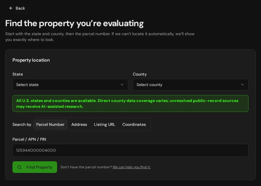
Start with an address, parcel number or listing. Keep the findings and questions for that property together in LandGauge.
On desktop, select an official source below to research side by side. Your review stays open while you switch sources. If a website will not display, use Open in new tab.
Confirm the governing jurisdiction first
Houston County is a geographic research starting point. Confirm the governing county, municipality and any other jurisdiction for the actual site. Check with the revenue office, probate records, planning or subdivision authority, county health department, road authority and floodplain administrator. Tax maps do not establish legal boundaries, access or buildability.
Official research resources
Houston County is a geographic research starting point. Confirm the governing county, municipality and any other jurisdiction for the actual site. Check with the revenue office, probate records, planning or subdivision authority, county health department, road authority and floodplain administrator. Tax maps do not establish legal boundaries, access or buildability.
Tap a resource to see its details, then open the official source. Use your browser’s Back or close control to return here.
GISHouston County GIS or parcel map
Open the county map entry listed by the Alabama Department of Revenue. Check its available parcel search and source date against the current county assessment record.
County maps and assessment records are for research and taxation; Alabama's Department of Revenue says tax maps cannot be used for conveyance. Confirm identifiers, acreage and boundaries against recorded instruments and a survey.
Open official source : Houston County GIS or parcel map (opens in a new tab)Parcel recordsHouston County revenue and appraisal offices
Find the county revenue commissioner, assessor or appraisal office and its listed assessment links in the Alabama Department of Revenue directory.
This is an office starting point. Confirm current record dates and coverage; assessment classifications and mapped parcel shapes do not establish zoning or legal-lot status.
Open official source : Houston County revenue and appraisal offices (opens in a new tab)PlanningHouston County planning — local authority discovery
Use the Alabama county websites directory to find the county government, then identify the actual county or municipal planning and subdivision authority.
The county website directory is not a zoning lookup. Verify whether zoning and subdivision controls apply at the exact location, along with setbacks, road access and utility approvals.
Open official source : Houston County planning — local authority discovery (opens in a new tab)Recorded documentsHouston County deeds and plats — probate office starting point
Use the Alabama Secretary of State probate judge directory to locate the county probate office, then obtain deeds, plats and recorded easements for the actual parcel.
The probate directory is an office starting point, not a document search. Confirm current records access and obtain actual instruments; a tax map is not a deed or title opinion.
Open official source : Houston County deeds and plats — probate office starting point (opens in a new tab)PlanningADPH on-site sewage and county health departments
Use Alabama Department of Public Health guidance to identify the county health department and the site evaluation and permit process.
Confirm the actual lot's permit, soil and site evaluation, system design, water and sewer options, and any subdivision review. A nearby septic system is not approval.
Open official source : ADPH on-site sewage and county health departments (opens in a new tab)Recorded documentsGeological Survey of Alabama Water Well Finder
Screen available water well records and nearby aquifer information through the state geological survey.
GSA states its digitized well records are incomplete. A missing or nearby well record does not establish the actual site's water supply, yield or quality; confirm through records and testing.
Open official source : Geological Survey of Alabama Water Well Finder (opens in a new tab)PlanningADECA Office of Water Resources
Check Alabama water-use reporting and Certificate of Use information for proposed large withdrawals.
Registration depends on the proposed use and capacity; do not infer that a normal household well needs a large-withdrawal certificate. Confirm project-specific requirements with OWR.
Open official source : ADECA Office of Water Resources (opens in a new tab)FloodAlabamaFlood and effective FEMA maps
Use ADECA's floodplain guidance and map access to locate the effective flood map for the property.
Confirm the effective map, map changes and local requirements with the community floodplain administrator. An unmapped area does not prove no flood risk.
Open official source : AlabamaFlood and effective FEMA maps (opens in a new tab)GISNational Wetlands Inventory mapper
Screen mapped wetlands and surface water before placing building pads, roads or fill.
NWI is a screening layer, not a field delineation or permit decision. Confirm applicable state and federal review for the proposed activity.
Open official source : National Wetlands Inventory mapper (opens in a new tab)TerrainNRCS Web Soil Survey
Screen soil and drainage limitations for septic, roads and foundations.
Regional soil mapping does not replace an on-site evaluation, system design or engineering review.
Open official source : NRCS Web Soil Survey (opens in a new tab)TerrainUSGS National Map
Screen elevation, slope and drainage context around the property.
Mapped roads and contours do not establish deeded access, road maintenance or a buildable envelope.
Open official source : USGS National Map (opens in a new tab)A practical Houston County research sequence
Maps and office directories are starting points. Zoning, subdivision, probate records, septic, water supply, wetlands, flood and access require current property-specific evidence.
- 1
Find the tax parcel and jurisdiction
Open the county map or Department of Revenue office directory, then compare the parcel number and mapped shape with current assessment records, probate instruments and a survey. Identify the county or municipality governing the site.
- 2
Check the proposed use or split
Ask the responsible local authority whether zoning, subdivision, road and building rules apply. Confirm lot status, setbacks, access and utilities; a tax parcel is not approval to build or divide.
- 3
Gather recorded and wastewater evidence
Request deeds, plats and easements from the probate office. Ask the county health department about the property's on-site sewage permit, site evaluation and any subdivision lot review.
- 4
Resolve water, flood, wetlands and coast
Screen GSA well records, effective flood maps, soils and wetlands, then obtain property-specific confirmation. For Baldwin and Mobile, determine whether the site falls inside ADEM's defined Coastal Area and whether the activity needs review.
Why Houston County research still requires manual verification
Probate records, planning files, health department permits and well information may require registration, payment, a call or an in-person request. Verify records, field conditions and jurisdiction before relying on a conclusion.
Houston County, Alabama GIS and zoning questions
Where can I find Houston County parcel information?
Use the county GIS link on this page when available, or start in the Alabama Department of Revenue's county office directory. Confirm the current assessment record with the local office. This page does not add automatic parcel lookup in LandGauge.
Does a tax map prove the parcel can be built on or split?
No. Alabama's Department of Revenue says tax maps are for tax purposes and cannot be used for conveyance. Ask the responsible local authority about legal-lot status, zoning, subdivision, access and permits; obtain recorded documents and a survey.
Where can I find deeds, plats and easements?
Use the Secretary of State's probate judge directory to locate the county probate office. Request the actual recorded instruments and confirm document access and fees with that office.
Who handles a septic permit or subdivision lot review?
Alabama Department of Public Health coordinates on-site sewage work through county health departments. Ask about the actual property's site evaluation, permit and any subdivision approval or sewer connection requirements.
Does a nearby well establish water supply?
No. Geological Survey well records are incomplete, and a nearby well does not establish the parcel's yield or water quality. Verify the actual source, testing and any water-use registration that applies to the proposed capacity.
Are all properties in Baldwin or Mobile counties in the Coastal Area?
No. ADEM defines the regulated Coastal Area within portions of those counties. Check the actual site and activity; coastal wetlands, beaches, larger development or subdivision, and certain groundwater wells may trigger separate review.
Does an empty flood or wetland map mean the site is clear?
No. Confirm the effective flood map and local requirements, and obtain field or agency review when wetlands or drainage may affect the planned work.
Turn the research into a property record
Start with Alabama and Houston County preselected. Add an address, parcel number or listing URL, then organize official findings, seller claims and unresolved questions in one Property Review.
Start the Property ReviewLandGauge organizes research starting points. County and map information may change and does not replace a survey, title examination, engineering review, floodplain determination, permit decision or professional advice.