Before You Split Land, Verify These County Records
A property may look divisible on a map, but the map does not confirm zoning, legal access, utilities, setbacks, or recorded restrictions. Before relying on a potential land split, verify the information through the agencies and public records that govern the property.
LandGauge Audio Guide
Listen to Leonard
Leonard explains how to find and follow recorded easement references—one part of verifying county records before relying on a possible split.
Listening time: 56 seconds
Prefer reading? Continue with the full guide below.
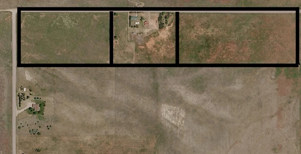
A Possible Split Is Only a Starting Point
Aerial maps, listing descriptions, parcel boundaries, and calculator results can reveal possibilities. They do not establish government approval or confirm that each proposed lot can be legally developed.
The Land Split Calculator helps you model what a property could become. County and city records help determine whether those assumptions are supportable. These are the county records to verify before splitting land.
Before deciding how much investigation a split may justify, you can also estimate the property’s preliminary value.
Records to Verify Before Relying on a Split
Requirements and record systems vary by jurisdiction. Start with these questions and keep the source for every answer.
Current zoning and permitted uses
Likely source: Planning and zoning department; current zoning map and ordinance
Minimum lot area and lot width
Likely source: Planning and zoning or the building department
Front, rear, and side setbacks
Likely source: Zoning ordinance, building department, and any applicable overlay
Subdivision and parcel-split requirements
Likely source: Planning department, subdivision administrator, or city or county clerk
Legal and physical access
Likely source: Recorder or clerk, title company, public works, and a surveyor
Recorded easements and restrictions
Likely source: Recorder or clerk, title commitment, deed, plat, and recorded declarations
Water and sewer availability
Likely source: Public works, serving utility, water district, or sewer district
Septic and well requirements
Likely source: Environmental health, health district, well regulator, or applicable state agency
Floodplain, wetlands, and drainage concerns
Likely source: Local floodplain administrator, FEMA, U.S. Fish and Wildlife Service, and public works
Survey, plat, deed, and parcel history
Likely source: Assessor, recorder or clerk, county GIS, title company, and a licensed surveyor
One office may direct you to another. Ask which current ordinance, map, recorded document, written determination, or agency confirmation applies to the specific property and proposed division.
Why Automated Research Does Not Always Work
Many county and city websites use search forms, document viewers, account requirements, CAPTCHA protections, or other systems that automated research tools cannot reliably access.
That does not mean the information is unavailable. It may require you to open the government website, search manually, and collect the relevant information.
When an automated lookup is limited, use the official source as the next step rather than treating the missing result as a conclusion about the property.
Bring What You Find Into LandGauge
When information cannot be retrieved automatically, you can enter the facts manually, paste relevant language, add a source link, or upload supported screenshots and documents.
LandGauge can then assist you in:
- Interpreting the information
- Identifying important facts
- Separating confirmed information from assumptions
- Recognizing missing evidence
- Organizing the results in the appropriate due-diligence section
- Preserving the source so you do not have to research it again
LandGauge assists the investigation. It does not turn preliminary information into verified approval, and it does not replace the responsible government agency or a qualified attorney, surveyor, engineer, title professional, environmental professional, or other licensed adviser.
The LandGauge Process
- Step 1
Estimate the value.
- Step 2
Explore the split.
- Step 3
Verify the property.
The Value Estimator helps establish a preliminary value range. The Land Split Calculator helps model what the property could become. The LandGauge due-diligence workflow helps investigate whether the plan is supported by evidence.
Before You Rely on the Plan
A promising layout is not the same as an approved land split. Explore the possibility, document the assumptions, and verify the property before you rely on the plan.
Frequently asked questions
Related guides
- Lot SplitsFound Land on Zillow? Verify the Split Before You BuyZillow, Redfin, and Realtor.com can help you find a possible land-split opportunity. Learn what listing sites can show, what they cannot verify, and how to underwrite two-, three-, and four-lot scenarios before you buy.
- Lot SplitsFour Proposed Lots Do Not Mean Four Buildable LotsA four-lot sketch is only a starting point. Learn how to verify legal division, buildable envelopes, access, utilities, wastewater, and evidence for every proposed lot.
- Lot Splits1–4 Lot Split OverviewMinor subdivisions look simple and rarely are. What to verify before assuming a split works.
- Due DiligenceHow to Tell if Land is Buildable: A Step-by-Step Due Diligence GuideA practical, twelve-point framework for evaluating whether a vacant parcel can realistically support a home or small development — before you make an offer.