Benton County GIS, zoning, parcel and flood-map resources
Use the official Benton County and federal sources below to locate a parcel, screen zoning and flood information, find recorded documents, and identify the department responsible for verification.
Keep your research beside your property review
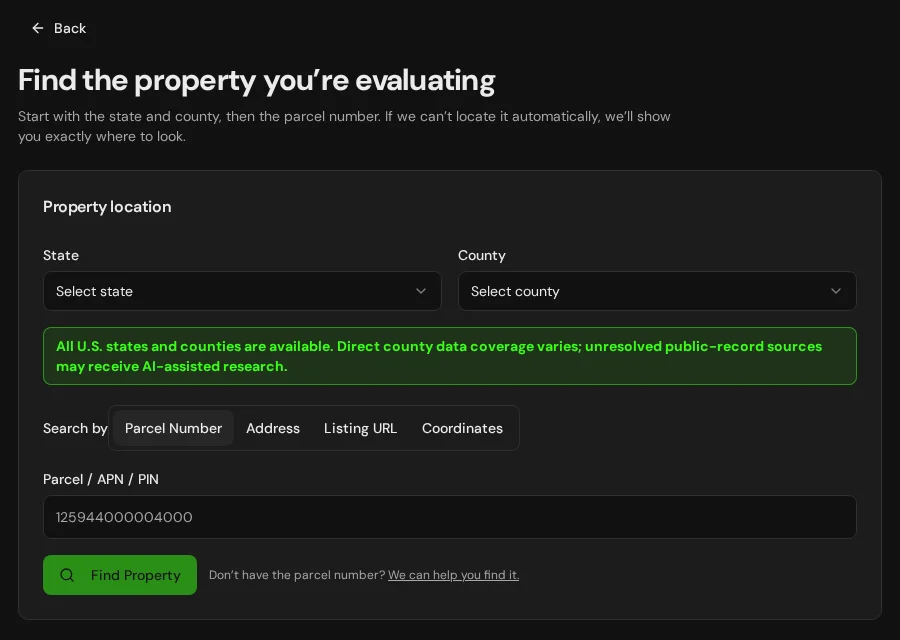
Start with an address, parcel number or listing. Keep the findings and questions for that property together in LandGauge.
On desktop, select an official source below to research side by side. Your review stays open while you switch sources. If a website will not display, use Open in new tab.
Confirm city versus county jurisdiction first
Benton County resources generally govern unincorporated land. If the property is inside Benton City, Kennewick, Prosser, Richland, or West Richland, verify the applicable city planning and zoning rules instead.
Official research resources
Open the source that matches the question you are trying to answer. Notes beneath each link explain the boundary of that source.
Tap a resource to see its details, then open the official source. Use your browser’s Back or close control to return here.
GISBenton County GIS Hub
Browse the county's official GIS datasets, downloads and mapping applications.
Best starting point for county GIS data and available map applications.
Open official source : Benton County GIS Hub (opens in a new tab)GISBenton County Web Maps
Open the official collection of zoning, building and public-works web maps.
Map layers are screening tools; confirm controlling requirements with the responsible jurisdiction.
Open official source : Benton County Web Maps (opens in a new tab)Parcel recordsBenton County Property Search
Search by parcel number or address and review the county's property record.
Assessment records do not establish zoning, legal access, buildability or surveyed boundaries.
Open official source : Benton County Property Search (opens in a new tab)ZoningBenton County Zoning Program
Review the official zoning-map resource and the county's explanation of zoning districts and standards.
The county identifies its official map as adopted December 18, 2018. Confirm amendments and the current designation with Planning.
Open official source : Benton County Zoning Program (opens in a new tab)If this source won’t open
Try opening the source in a new tab. It may be temporarily unavailable or require a browser security check.
Use Benton County’s GIS hub for map discovery, or ask Planning to confirm the zoning and requirements. Inside city limits, check with city planning. A map alone does not approve your proposed use.
Keep this answer unknown until you can verify it. Save a note about what you still need to check. Opening a link or contacting an office does not confirm an answer.
PlanningBenton County Planning Division
Confirm zoning, permitted uses, setbacks, minimum lot sizes, subdivisions and permit requirements.
Planning: 509-786-5612 · planning.department@co.benton.wa.us
Open official source : Benton County Planning Division (opens in a new tab)If this source won’t open
Try opening the source in a new tab. It may be temporarily unavailable or require a browser security check.
Use Benton County’s GIS hub for map discovery, or ask Planning to confirm the zoning and requirements. Inside city limits, check with city planning. A map alone does not approve your proposed use.
Keep this answer unknown until you can verify it. Save a note about what you still need to check. Opening a link or contacting an office does not confirm an answer.
Recorded documentsBenton County Recorded Document Search
Search the Auditor's index of recorded documents from January 1972 forward.
An index search is not a title examination and may not reveal every right or encumbrance affecting a parcel.
Open official source : Benton County Recorded Document Search (opens in a new tab)FloodFEMA Map Service Center
Locate effective National Flood Insurance Program maps and related flood-map products.
Distinguish effective maps from preliminary or draft mapping before relying on a flood-zone result.
Open official source : FEMA Map Service Center (opens in a new tab)If this source won’t open
Try opening the source in a new tab. It may be temporarily unavailable or require a browser security check.
Try FEMA’s effective flood map viewer. Confirm the panel and effective date; missing results do not establish that the property is outside a flood zone. You can also ask FEMA’s map specialists for help.
Keep this answer unknown until you can verify it. Save a note about what you still need to check. Opening a link or contacting an office does not confirm an answer.
FloodBenton County Draft Floodplain Mapping
Review Benton County's Risk MAP experience for proposed flood-hazard mapping.
Draft or preliminary mapping is not the same as the currently effective FEMA map.
Open official source : Benton County Draft Floodplain Mapping (opens in a new tab)TerrainUSGS National Map
Screen elevation, contours, hydrography and topographic context from a federal source.
Regional terrain data does not replace a boundary, topographic or site survey.
Open official source : USGS National Map (opens in a new tab)Benton County Zoning Program
Review the official zoning-map resource and the county's explanation of zoning districts and standards.
The county identifies its official map as adopted December 18, 2018. Confirm amendments and the current designation with Planning.
Open official sourceIf this source won’t open
Try opening the source in a new tab. It may be temporarily unavailable or require a browser security check.
Use Benton County’s GIS hub for map discovery, or ask Planning to confirm the zoning and requirements. Inside city limits, check with city planning. A map alone does not approve your proposed use.
Keep this answer unknown until you can verify it. Save a note about what you still need to check. Opening a link or contacting an office does not confirm an answer.
Benton County Planning Division
Confirm zoning, permitted uses, setbacks, minimum lot sizes, subdivisions and permit requirements.
Planning: 509-786-5612 · planning.department@co.benton.wa.us
Open official sourceIf this source won’t open
Try opening the source in a new tab. It may be temporarily unavailable or require a browser security check.
Use Benton County’s GIS hub for map discovery, or ask Planning to confirm the zoning and requirements. Inside city limits, check with city planning. A map alone does not approve your proposed use.
Keep this answer unknown until you can verify it. Save a note about what you still need to check. Opening a link or contacting an office does not confirm an answer.
FEMA Map Service Center
Locate effective National Flood Insurance Program maps and related flood-map products.
Distinguish effective maps from preliminary or draft mapping before relying on a flood-zone result.
Open official sourceIf this source won’t open
Try opening the source in a new tab. It may be temporarily unavailable or require a browser security check.
Try FEMA’s effective flood map viewer. Confirm the panel and effective date; missing results do not establish that the property is outside a flood zone. You can also ask FEMA’s map specialists for help.
Keep this answer unknown until you can verify it. Save a note about what you still need to check. Opening a link or contacting an office does not confirm an answer.
A safer Benton County research sequence
The order matters because the correct source depends on both the parcel and its governing jurisdiction.
- 1
Identify the governing jurisdiction
Determine whether the parcel is inside an incorporated city or unincorporated Benton County before relying on a zoning map or planning contact.
- 2
Match the question to the source
Use GIS for map context, the Assessor for assessment records, Planning for zoning and development standards, and the Auditor for recorded-document searches.
- 3
Separate map status from conclusions
A displayed boundary or layer is a research lead. It is not automatically a surveyed boundary, legal-access determination, title conclusion or permit approval.
- 4
Record what still needs verification
Save sources, dates, assumptions and follow-up questions in a Property Review before making a purchase or development decision.
Current planning note
Benton County identifies an official zoning map adopted December 18, 2018, while its 2026 Comprehensive Plan and development-regulation update is in progress. Treat the online map as a starting point and ask Planning to confirm the current parcel designation and applicable standards.
Benton County GIS and zoning questions
Where is the official Benton County GIS?
Benton County publishes an ArcGIS Hub with county datasets, downloads and web-map applications. LandGauge links directly to both the GIS Hub and its Web Maps collection.
Does the Benton County GIS prove a property boundary?
No. GIS parcel lines are useful for screening and orientation, but they do not replace recorded documents or a boundary survey by a licensed land surveyor.
Which zoning rules apply to a Benton County property?
That depends on jurisdiction. Benton County generally administers unincorporated land. Properties inside Benton City, Kennewick, Prosser, Richland or West Richland may be governed by the applicable city.
Which flood map should I rely on?
Begin with FEMA's effective map products and verify the applicable status with the local floodplain administrator. Preliminary or draft mapping can indicate future risk or changes but is not the same as the currently effective map.
Turn county research into a property record
Start with Washington and Benton County preselected, then add the address, parcel number or listing URL. LandGauge keeps located facts separate from claims and items that still need verification.
Start the Property ReviewLandGauge organizes research starting points. County and map information may change and does not replace a survey, title examination, engineering review, floodplain determination, permit decision or professional advice.