Washington County, Utah GIS, zoning, parcel and flood-map resources
Use the official Washington County, Utah, state and federal sources below to locate a parcel, identify the governing jurisdiction, review zoning and planning information, find recorded surveys and screen flood or geologic constraints.
Keep your research beside your property review
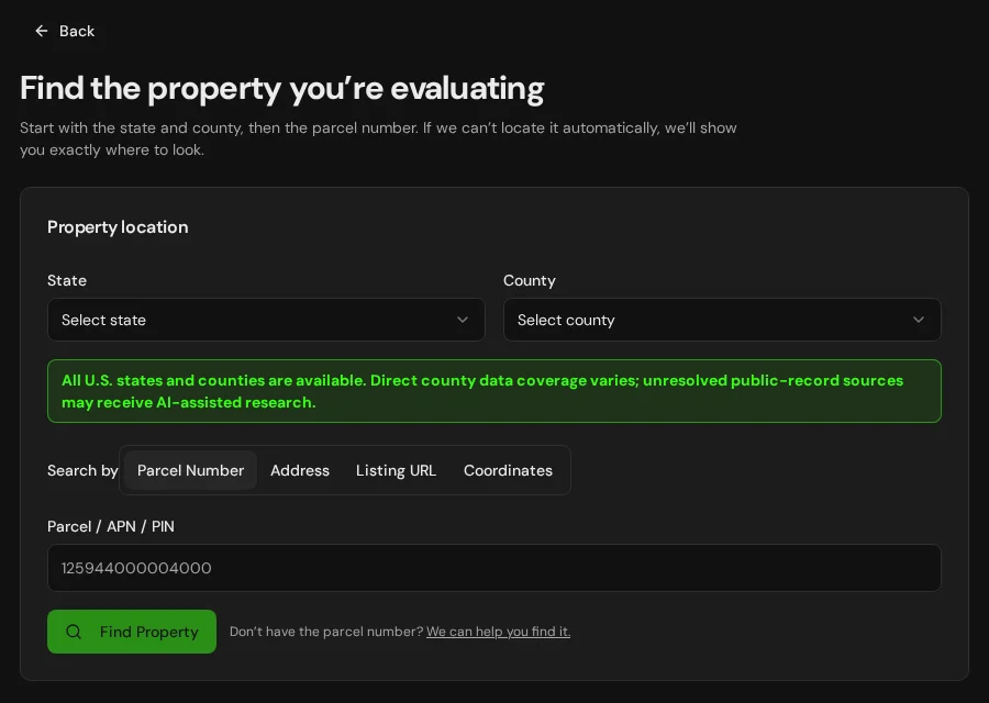
Start with an address, parcel number or listing. Keep the findings and questions for that property together in LandGauge.
On desktop, select an official source below to research side by side. Your review stays open while you switch sources. If a website will not display, use Open in new tab.
Confirm the governing jurisdiction first
Washington County administers land use primarily in unincorporated areas. Parcels inside St. George, Washington City, Hurricane, Ivins, Santa Clara or another municipality may be governed by that city's zoning, subdivision and permitting rules. Confirm the actual jurisdiction before relying on a county layer or standard.
Official research resources
Washington County provides strong public mapping, but the answers are split among different viewers, offices and records. Use the system that matches the question and preserve any manual follow-up.
Tap a resource to see its details, then open the official source. Use your browser’s Back or close control to return here.
GISWashington County Map Inventory
Open the county's official directory of GIS, recorder, assessor, community-development, aerial and public-works viewers.
The county separates different questions among several viewers. Start with the inventory, then choose the map that matches the record you need.
Open official source : Washington County Map Inventory (opens in a new tab)ZoningWashington County Community Development Map
Search an existing parcel by parcel number or address and screen zoning and general-plan information.
Mapped zoning is a research starting point. Confirm jurisdiction, overlays and property-specific requirements with the responsible planning office.
Open official source : Washington County Community Development Map (opens in a new tab)Parcel recordsWashington County Assessor
Open the county's official assessor search for parcel characteristics, valuation records, reports, images and sketches.
Assessment records do not prove surveyed boundaries, legal access, zoning, water rights or buildability.
Open official source : Washington County Assessor (opens in a new tab)ZoningWashington County Zoning Information
Review the county zoning map, area maps, overlay zones and dimensional-reference tables for unincorporated land.
Check the base zone and every applicable overlay. A mapped classification alone does not confirm that a proposed use or division will be approved.
Open official source : Washington County Zoning Information (opens in a new tab)PlanningWashington County Community Development
Find the county office responsible for planning, zoning, subdivision review, building permits, boundary adjustments and code compliance.
Community Development: 435-301-7250. Ask for property-specific confirmation when the map or code leaves a material question unresolved.
Open official source : Washington County Community Development (opens in a new tab)PlanningWashington County Planning Applications
Find current county checklists for boundary adjustments, subdivisions, amended plats, zone changes, variances and planned developments.
Application checklists identify submission requirements; they do not represent approval of a specific property or proposal.
Open official source : Washington County Planning Applications (opens in a new tab)Recorded documentsWashington County Recorder / Surveyor
Locate recorded documents, ownership plats, subdivision plats and survey records through the county Recorder and Surveyor office.
Online indexes and mapped records are not a title examination. Some copies, historical records or certifications may require a manual request or fee.
Open official source : Washington County Recorder / Surveyor (opens in a new tab)Recorded documentsWashington County Record of Survey
Review the county's official survey-record guidance and access path for filed Records of Survey.
A filed survey can help explain prior boundary work, but current property boundaries still require review of the applicable record and, when needed, a licensed surveyor.
Open official source : Washington County Record of Survey (opens in a new tab)FloodWashington County Public Works & Floodplain
Find county flood-control information, the floodplain development permit and road or drainage standards.
Confirm the effective FEMA map and ask the responsible floodplain administrator about parcel-specific permits, elevations or supporting studies.
Open official source : Washington County Public Works & Floodplain (opens in a new tab)TerrainUtah Geological Survey Hazard Maps
Screen mapped faults, landslides, problem soils and other geologic hazards, including studies specific to southwestern Utah.
Regional hazard mapping does not replace a site-specific geotechnical investigation or engineering determination.
Open official source : Utah Geological Survey Hazard Maps (opens in a new tab)FloodFEMA Map Service Center
Locate effective National Flood Insurance Program maps and related flood-hazard products for a property.
Confirm whether a displayed product is effective, preliminary or historical before relying on its flood-zone information.
Open official source : FEMA Map Service Center (opens in a new tab)If this source won’t open
Try opening the source in a new tab. It may be temporarily unavailable or require a browser security check.
Try FEMA’s effective flood map viewer. Confirm the panel and effective date; missing results do not establish that the property is outside a flood zone. You can also ask FEMA’s map specialists for help.
Keep this answer unknown until you can verify it. Save a note about what you still need to check. Opening a link or contacting an office does not confirm an answer.
Washington County Map Inventory
Open the county's official directory of GIS, recorder, assessor, community-development, aerial and public-works viewers.
The county separates different questions among several viewers. Start with the inventory, then choose the map that matches the record you need.
Open official sourceWashington County Community Development Map
Search an existing parcel by parcel number or address and screen zoning and general-plan information.
Mapped zoning is a research starting point. Confirm jurisdiction, overlays and property-specific requirements with the responsible planning office.
Open official sourceWashington County Assessor
Open the county's official assessor search for parcel characteristics, valuation records, reports, images and sketches.
Assessment records do not prove surveyed boundaries, legal access, zoning, water rights or buildability.
Open official sourceWashington County Zoning Information
Review the county zoning map, area maps, overlay zones and dimensional-reference tables for unincorporated land.
Check the base zone and every applicable overlay. A mapped classification alone does not confirm that a proposed use or division will be approved.
Open official sourceWashington County Community Development
Find the county office responsible for planning, zoning, subdivision review, building permits, boundary adjustments and code compliance.
Community Development: 435-301-7250. Ask for property-specific confirmation when the map or code leaves a material question unresolved.
Open official sourceWashington County Planning Applications
Find current county checklists for boundary adjustments, subdivisions, amended plats, zone changes, variances and planned developments.
Application checklists identify submission requirements; they do not represent approval of a specific property or proposal.
Open official sourceWashington County Recorder / Surveyor
Locate recorded documents, ownership plats, subdivision plats and survey records through the county Recorder and Surveyor office.
Online indexes and mapped records are not a title examination. Some copies, historical records or certifications may require a manual request or fee.
Open official sourceWashington County Record of Survey
Review the county's official survey-record guidance and access path for filed Records of Survey.
A filed survey can help explain prior boundary work, but current property boundaries still require review of the applicable record and, when needed, a licensed surveyor.
Open official sourceWashington County Public Works & Floodplain
Find county flood-control information, the floodplain development permit and road or drainage standards.
Confirm the effective FEMA map and ask the responsible floodplain administrator about parcel-specific permits, elevations or supporting studies.
Open official sourceUtah Geological Survey Hazard Maps
Screen mapped faults, landslides, problem soils and other geologic hazards, including studies specific to southwestern Utah.
Regional hazard mapping does not replace a site-specific geotechnical investigation or engineering determination.
Open official sourceFEMA Map Service Center
Locate effective National Flood Insurance Program maps and related flood-hazard products for a property.
Confirm whether a displayed product is effective, preliminary or historical before relying on its flood-zone information.
Open official sourceA practical Washington County research sequence
The order matters because parcel mapping, zoning, planning, recorded documents and hazard screening do not automatically reconcile with one another.
- 1
Identify the governing city or county
Determine whether the parcel is inside an incorporated municipality or in unincorporated Washington County before relying on a zoning map, subdivision standard or permit process.
- 2
Match the parcel across the viewers
Carry the same parcel number through the assessor, Community Development map, recorder and flood tools. Each system answers a different question.
- 3
Test legal-lot and buildability questions
Check when the lot was created, zone area and width, approved access, water, septic feasibility, power, fire protection, overlays and flood or geologic constraints.
- 4
Save the source and finish manual follow-up
Record what the official source shows, keep unanswered items pending, and obtain property-specific confirmation from the responsible city, county or professional.
Why some Washington County verification is still manual
The county's public information is distributed among the GIS inventory, Community Development map, assessor, recorder and survey systems. A legal-building-lot review can also require separate confirmation of approved access, water, septic feasibility, power, fire suppression, flood requirements and geologic conditions. LandGauge should preserve those open questions—not convert a missing answer into an assumption.
Washington County, Utah GIS and zoning questions
Where is the official Washington County, Utah GIS?
Washington County publishes a Map Inventory that links to separate GIS, assessor, recorder, Community Development, aerial and public-works viewers. The Community Development map supports parcel-number and address searches for zoning and general-plan screening.
Does Washington County zoning apply to every property with a Washington County address?
No. A mailing address does not establish land-use jurisdiction. Parcels inside St. George, Washington City, Hurricane, Ivins, Santa Clara or another municipality may be governed by that city's zoning, subdivision and permitting rules.
What should I check before treating land as a legal building lot?
Washington County identifies several separate questions: when the lot was created or modified, zone minimums, approved access, water, septic feasibility, power and fire suppression. Flood, geologic and overlay constraints may add further review.
Can LandGauge automatically verify every Washington County record?
No. The county distributes information among multiple viewers and offices. Recorded documents, surveys, historical plats and property-specific determinations may require a manual search, request, fee or staff confirmation. LandGauge organizes the work without turning missing automation into an assumed answer.
Does the parcel map prove the property boundary or legal access?
No. Parcel mapping is useful for screening and locating records, but it does not replace recorded documents, a title examination or a boundary survey by a licensed land surveyor.
Turn the research into a property record
Start with Utah and Washington County preselected, then add the address, parcel number or listing URL. LandGauge keeps located facts separate from claims, manual findings and items that still need verification.
Start the Property ReviewLandGauge organizes research starting points. County and map information may change and does not replace a survey, title examination, engineering review, floodplain determination, permit decision or professional advice.