How to Verify Utilities on Vacant Land: Service, Capacity, and Connection Costs
Updated September 25, 2026
Quick answer
AI can help identify utility providers, official documents, service maps, policies, and published fees. It cannot by itself confirm that the provider will serve a particular parcel, that capacity is available, that the parcel has a usable connection route, or what the complete connection will cost. Those facts require parcel-specific confirmation from the responsible utility, public works department, agency, or qualified professional.
Online research makes utility due diligence faster. It points you to the right provider and the right questions. This guide shows how to turn that research into parcel-specific evidence before you rely on a utility claim in a land deal.
Watch the short
Video summary
This short from LandGauge accompanies this guide on verifying utilities before buying vacant land. It is a summary, not a transcript: an exact caption transcript was not available from YouTube, so none is reproduced here.
A real-world example
When I evaluated a small land split in Downey, Idaho, everything looked good at first: paved road access, sewer and water in the area, and visible power lines. What I could not tell from a map or a drive-by was whether those utilities were actually usable for the project—whether there was capacity, whether new connections were allowed, and what upgrades and fees would apply. Those answers had to come from the city and the utilities, not from the map.
Keep these distinctions in mind
- Research is not verification.
- An official source is not necessarily parcel-specific confirmation.
- A utility line nearby does not prove that the parcel can connect.
- A service territory does not confirm available capacity.
- Published fees do not establish the final connection cost.
- A listing claim is not verification.
- A red flag or missing answer requires investigation; it does not prove the property has a defect.
1. What “utilities available” actually means
“Available,” “nearby,” “at the road,” and “in the area” are not the same as confirmed service. Each phrase may be technically accurate and still leave the important questions unanswered: which provider, whether it serves this parcel, whether capacity exists, where the connection point is, and what connecting will cost. Treat every one of them as a lead to verify.
2. Research versus verification
Research may show
- A likely provider
- A service-area map
- A nearby utility line
- Published policies or fee schedules
- Nearby developed properties
- An official government or utility webpage
Verification must establish
- Whether the provider serves this exact parcel
- Whether capacity is currently available
- Where the approved connection point is located
- Whether an easement or extension is necessary
- Whether upgrades are required
- What applications, engineering, deposits, and fees apply
- The likely total connection cost and timing
3. Four levels of utility evidence
Level 1
Listing or seller claim
Useful as a lead, but unverified.
Level 2
Public and AI-assisted research
Useful for locating providers, documents, maps, policies, and questions.
Level 3
Parcel-specific utility confirmation
The responsible provider confirms service eligibility, capacity, connection requirements, and known fees for the identified parcel.
Level 4
Project-specific professional evidence
Engineering, field review, written estimates, approved plans, permits, easements, extension agreements, or formal utility commitments when the project requires them.
Not every property needs Level 4 evidence before an initial purchase decision. The level you need depends on the proposed use, the deal risk, and how complex the development is. A simple single-home purchase may be well served by Level 3; a multi-lot split or a project needing a line extension may need Level 4.
4. Step-by-step utility-verification workflow
- Identify the parcel correctly using the parcel number, legal description, county, and map.
- Identify the responsible provider for each utility.
- Review official service maps, policies, and published fees.
- Determine whether infrastructure is merely nearby or practically reachable.
- Contact the utility with parcel-specific information.
- Ask about service eligibility, capacity, connection point, extensions, easements, upgrades, applications, timing, and fees.
- Request written confirmation when available.
- Save the source, contact, date, response, remaining questions, and supporting documents.
- Keep researched information separate from verified evidence.
5. Questions to ask the utility
- Do you serve this exact parcel?
- Is capacity currently available for the intended use?
- Where is the approved connection point?
- How far is that point from the proposed building area?
- Is the existing line public, private, or shared?
- Are easements or off-site permissions required?
- Must the owner fund a line extension, transformer, pump, meter, tap, or system upgrade?
- Are impact fees, capacity fees, deposits, engineering reviews, or application fees required?
- What information is needed for a written estimate?
- How long does the approval and connection process normally take?
- How long is the utility’s answer or estimate valid?
- Who has final authority to approve the connection?
6. Utility-specific considerations
Electric
- Serving utility
- Transformer and line capacity
- Service voltage or phase when relevant
- Extension distance
- Pole, trench, transformer, and meter requirements
- Easements and road crossings
Public water
- Service boundary
- Main location
- Capacity
- Meter or tap availability
- Pressure and fire-flow requirements when applicable
- Extension and impact fees
Public sewer
- Main location and depth
- Gravity versus pumped connection
- Capacity
- Tap and impact fees
- Extension requirements
- Whether annexation or a development agreement is involved
Gas and telecommunications
- Provider coverage
- Physical infrastructure
- Extension requirements
- Difference between advertised coverage and an actual serviceable address
Where public water or sewer is not available, wells and septic systems may be alternatives. Those have their own verification process—see water wells and vacant land and septic due diligence.
7. What AI can and cannot do
AI can
- Locate likely official sources
- Summarize utility policies
- Identify missing information
- Help prepare questions
- Organize evidence
- Flag conflicts between sources
AI cannot independently guarantee
- Parcel eligibility
- Current capacity
- Connection approval
- Easement rights
- Final engineering requirements
- Final connection cost
- Permit or agency approval
8. How LandGauge supports the workflow
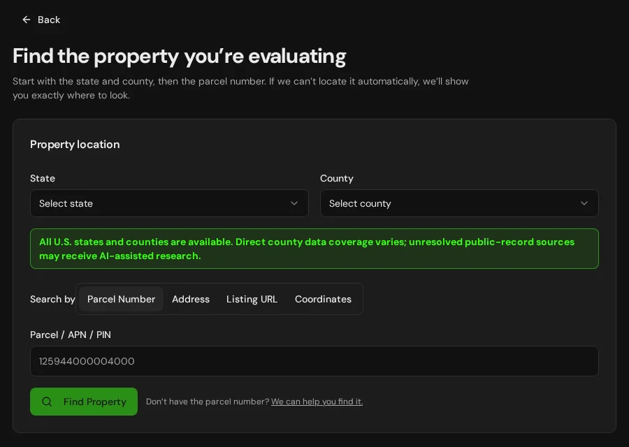
LandGauge does not merely display a utility layer or nearby infrastructure. It helps you understand what is known, what is assumed, what still needs verification, and what action should come next. With LandGauge you can:
- Add property-specific information for review
- Organize official research
- Identify unresolved utility questions
- Distinguish useful knowledge from verified evidence
- Save sources and supporting information
- Carry missing utility items into the Property Review workflow
9. Practical verification record
Keep one record per utility. Record the provider’s department or role, not private personal information.
- Parcel number
- Utility type
- Provider
- Contact name or department
- Contact method
- Date contacted
- Service confirmed?
- Capacity confirmed?
- Connection point
- Extension required?
- Easement required?
- Published fees
- Preliminary estimate
- Written confirmation received?
- Remaining questions
- Supporting source or document
10. Conclusion
AI research can make utility due diligence faster and more organized, but it should produce better questions—not false certainty. Confirm the parcel, the provider, the capacity, the connection route, and the cost before relying on a utility claim in the deal.
Verify the property. Explore the possibilities. Underwrite the deal.
Frequently Asked Questions
Related guides
LandGauge organizes research and identifies verification needs. It does not guarantee utility service, capacity, costs, permits, easements, or agency approval, and it does not replace utilities, agencies, engineers, surveyors, or attorneys.