District research guide
Washington, DC GIS, zoning, deeds and land research
Find the District's parcel and zoning maps, recorded documents, subdivision plat process, flood maps and utility review path. Start with an address or Square-Suffix-Lot, then carry the findings into a Property Review.
Keep your research beside your property review
Start with an address, parcel number or listing. Keep the findings and questions for that property together in LandGauge.
On desktop, select an official source below to research side by side. Your review stays open while you switch sources. If a website will not display, use Open in new tab.
Identify the lot
DC property records use square, suffix and lot identifiers. Confirm the exact record and address.
Read recorded rights
The Recorder of Deeds holds instruments; a mapped tax lot alone does not prove access or title.
Confirm approvals
Zoning and subdivision plats have separate District review paths. Check the proposed use and lot status.
Check site conditions
Flood maps and nearby utility lines are screening leads. Ask the responsible office about the specific project.
Official District research resources
Follow the original records and ask the responsible office about the property. These links do not establish automated parcel retrieval into LandGauge.
Last checked: October 7, 2026
Tap a resource to see its details, then open the official source. Use your browser’s Back or close control to return here.
Parcel and GISDC Real Property GIS and assessment
Search assessment and map records by address or Square-Suffix-Lot. Confirm the tax identifier and current record; the assessment map is not a boundary survey.
Open official source : DC Real Property GIS and assessment (opens in a new tab)ZoningOfficial DC zoning map
Find the mapped zone by address or square and lot, then check applicable regulations and any case history. A mapped designation does not approve a proposed project.
Open official source : Official DC zoning map (opens in a new tab)Zoning and permitsDepartment of Buildings zoning services
Ask the Office of Zoning Administration about zoning certification, lot dimensions, use and a proposed subdivision.
Open official source : Department of Buildings zoning services (opens in a new tab)Subdivision platsGet a subdivision plat
Follow the District's Surveyor and Zoning Administration review path for a proposed new lot. Confirm recorded plat and approval status before treating a lot as legal.
Open official source : Get a subdivision plat (opens in a new tab)Recorded documentsRecorder of Deeds document images
Search recorded deeds and other instruments, including easements. Review the actual documents and title history with a qualified professional.
Open official source : Recorder of Deeds document images (opens in a new tab)FloodDOEE flood risk maps
Screen District flood hazard maps and compare effective FEMA information. Ask DOEE about site-specific floodplain requirements.
Open official source : DOEE flood risk maps (opens in a new tab)Water and sewerDC Water availability
Ask DC Water about water and sewer connection requirements and the availability review for a proposed project. Nearby mains do not establish service approval.
Open official source : DC Water availability (opens in a new tab)Parcel and GIS
DC Real Property GIS and assessment
Search assessment and map records by address or Square-Suffix-Lot. Confirm the tax identifier and current record; the assessment map is not a boundary survey.
Open official sourceZoning
Official DC zoning map
Find the mapped zone by address or square and lot, then check applicable regulations and any case history. A mapped designation does not approve a proposed project.
Open official sourceZoning and permits
Department of Buildings zoning services
Ask the Office of Zoning Administration about zoning certification, lot dimensions, use and a proposed subdivision.
Open official sourceSubdivision plats
Get a subdivision plat
Follow the District's Surveyor and Zoning Administration review path for a proposed new lot. Confirm recorded plat and approval status before treating a lot as legal.
Open official sourceRecorded documents
Recorder of Deeds document images
Search recorded deeds and other instruments, including easements. Review the actual documents and title history with a qualified professional.
Open official sourceFlood
DOEE flood risk maps
Screen District flood hazard maps and compare effective FEMA information. Ask DOEE about site-specific floodplain requirements.
Open official sourceWater and sewer
DC Water availability
Ask DC Water about water and sewer connection requirements and the availability review for a proposed project. Nearby mains do not establish service approval.
Open official sourceA practical DC research sequence
1. Locate the property
Match the address and Square-Suffix-Lot in DC OTR records; use a survey when legal boundaries matter.
2. Read zoning and land records
Compare the official zoning map with the Recorder of Deeds instruments, including easements and restrictions.
3. Confirm the proposed use or split
Ask DOB Zoning Administration and the Surveyor about current lot status, subdivision plats, permits and applicable standards.
4. Check flood and utilities
Screen DOEE flood information and ask DC Water about connection and availability for the specific project.
Turn research into a property record
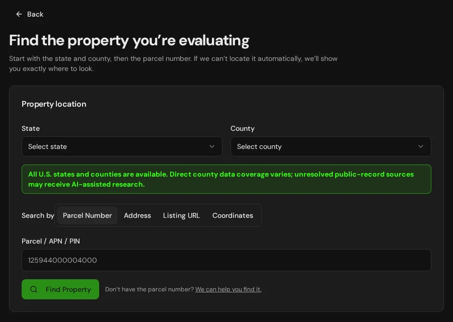
Start with DC and District of Columbia selected. Add an address, parcel identifier or listing URL, then organize official findings and questions needing verification.
Start the Property ReviewLandGauge organizes research starting points. Map and tax records do not replace a survey, title examination, zoning determination, floodplain review, utility approval or permit decision.