Bristol, Connecticut parcel, zoning and land-record research
Research Bristol through the town assessor, clerk, planning office, health agency and wetlands agency. Start with the municipality's linked GIS and assessor resources. Use statewide parcels as a cross-check, then organize property-specific evidence in a Property Review.
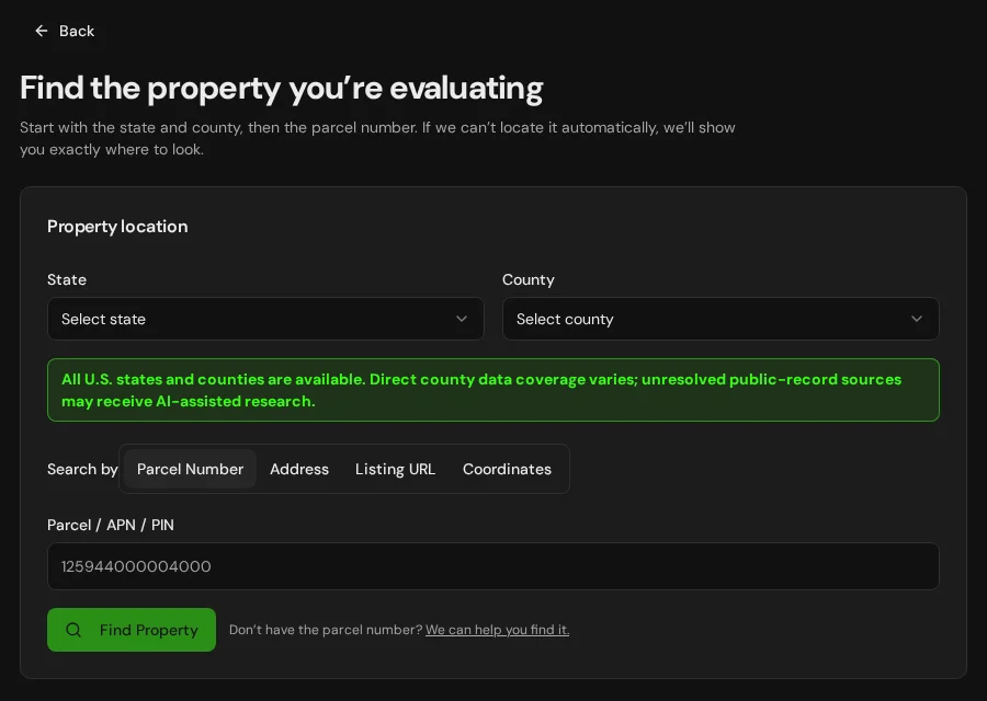
The review preselects Bristol, Connecticut and Naugatuck Valley Planning Region. Enter the address or parcel identifier there; the property is not automatically verified.
Keep your research beside your property review
Start with an address, parcel number or listing. Keep the findings and questions for that property together in LandGauge.
On desktop, select an official source below to research side by side. Your review stays open while you switch sources. If a website will not display, use Open in new tab.
Bristol is a Connecticut municipality in the historical Hartford County area and the Naugatuck Valley Planning Region. The eight historical counties have no county government. Confirm zoning, land records, assessment and inland wetlands decisions with the town and the appropriate health district.
Official research resources
If a map or record site changes or will not open, start from the municipal pages that link to it:
Tap a resource to see its details, then open the official source. Use your browser’s Back or close control to return here.
GISBristol official GIS and parcel maps
Open the MapXpress GIS portal linked by Bristol's city maps page to locate a parcel and review available layers.
This GIS is linked by the municipality. Mapped boundaries and layers are screening sources, not a survey, legal lot determination or approval to build. Confirm discrepancies and source dates with the responsible office.
Open official source : Bristol official GIS and parcel maps (opens in a new tab)Bristol municipal GIS source page (opens in a new tab)RecordsBristol assessor and property information
Find Bristol's assessor contacts and the city's current link to its Vision property database.
Check the exact property, assessment date and record identifiers. Assessor acreage and zoning labels do not replace a survey or planning confirmation.
Open official source : Bristol assessor and property information (opens in a new tab)RecordsBristol Vision property records
Review assessment records in the Vision database linked by Bristol's assessor.
The database describes its records as a work in progress. Confirm identifiers, dates and discrepancies with the assessor before relying on them.
Open official source : Bristol Vision property records (opens in a new tab)Bristol assessor source page (opens in a new tab)GISConnecticut statewide parcels and CAMA
Use the state GIS parcel viewer to screen Bristol tax-parcel geometry and assessment data, then confirm source dates with the town assessor.
The state integrates municipal files; spatial accuracy and completeness vary. This is tax and screening context, not a survey, deed or current approval.
Open official source : Connecticut statewide parcels and CAMA (opens in a new tab)PlanningBristol municipal office directory
Find the town website and its planning, zoning, assessor and other municipal contacts in the Connecticut State Register.
This alphabetical state directory is a contact path. Confirm current staff, regulations, maps and meeting decisions with the town itself.
Open official source : Bristol municipal office directory (opens in a new tab)RecordsBristol town clerk contact
Find the town clerk to request recorded deeds, maps, easements and restrictions for the exact parcel.
Recorded instruments and survey evidence are distinct from a tax-parcel map. Search availability and fees vary by town.
Open official source : Bristol town clerk contact (opens in a new tab)PlanningNaugatuck Valley Planning Region directory
Check which regional planning geography LandGauge's Connecticut intake uses for Bristol.
The planning region is an intake geography, not the town's zoning or deed-recording authority.
Open official source : Naugatuck Valley Planning Region directory (opens in a new tab)PlanningConnecticut local land-use authority
Review DEEP's explanation of town-level planning and zoning, then ask Bristol for property-specific rules.
Current zoning maps, subdivision approvals, frontage and legal lot status require direct town confirmation.
Open official source : Connecticut local land-use authority (opens in a new tab)PlanningMunicipal inland wetlands permitting
Ask Bristol's inland wetlands agency whether proposed activity needs a municipal wetlands review.
A blank mapped layer is not clearance. Site delineation, municipal review and other permits may be required.
Open official source : Municipal inland wetlands permitting (opens in a new tab)GISCT ECO environmental maps
Screen wetland soils, aquifer protection, water quality and drainage context in official Connecticut GIS tools.
Generalized GIS layers do not establish site-specific regulatory boundaries or buildability.
Open official source : CT ECO environmental maps (opens in a new tab)PlanningConnecticut DPH subsurface sewage standards
Review septic standards and ask the local health agency for records, site tests and approval requirements.
A nearby system or soil map does not approve this property or proposed new lots; larger systems may use a different state review path.
Open official source : Connecticut DPH subsurface sewage standards (opens in a new tab)RecordsFind the local health department or district
Identify the health agency serving Bristol for septic and private-well questions.
Health districts do not follow historical county boundaries; confirm jurisdiction for the exact town.
Open official source : Find the local health department or district (opens in a new tab)RecordsConnecticut DPH private wells
Review well records and water-quality guidance, then ask the responsible local health authority about this site.
A neighboring well does not establish yield, safe water or approval for this parcel.
Open official source : Connecticut DPH private wells (opens in a new tab)FloodFEMA Map Service Center
Find effective flood maps and revisions for the parcel.
Flood risk and local restrictions can exist outside mapped special flood hazard areas.
Open official source : FEMA Map Service Center (opens in a new tab)If this source won’t open
Try opening the source in a new tab. It may be temporarily unavailable or require a browser security check.
Try FEMA’s effective flood map viewer. Confirm the panel and effective date; missing results do not establish that the property is outside a flood zone. You can also ask FEMA’s map specialists for help.
Keep this answer unknown until you can verify it. Save a note about what you still need to check. Opening a link or contacting an office does not confirm an answer.
TerrainNRCS Web Soil Survey
Screen mapped drainage and soils relevant to septic, roads and foundations.
Mapped soils do not replace a field evaluation or engineering.
Open official source : NRCS Web Soil Survey (opens in a new tab)Bristol official GIS and parcel maps
Open the MapXpress GIS portal linked by Bristol's city maps page to locate a parcel and review available layers.
This GIS is linked by the municipality. Mapped boundaries and layers are screening sources, not a survey, legal lot determination or approval to build. Confirm discrepancies and source dates with the responsible office.
Open official sourceBristol assessor and property information
Find Bristol's assessor contacts and the city's current link to its Vision property database.
Check the exact property, assessment date and record identifiers. Assessor acreage and zoning labels do not replace a survey or planning confirmation.
Open official sourceBristol Vision property records
Review assessment records in the Vision database linked by Bristol's assessor.
The database describes its records as a work in progress. Confirm identifiers, dates and discrepancies with the assessor before relying on them.
Open official sourceConnecticut statewide parcels and CAMA
Use the state GIS parcel viewer to screen Bristol tax-parcel geometry and assessment data, then confirm source dates with the town assessor.
The state integrates municipal files; spatial accuracy and completeness vary. This is tax and screening context, not a survey, deed or current approval.
Open official sourceBristol municipal office directory
Find the town website and its planning, zoning, assessor and other municipal contacts in the Connecticut State Register.
This alphabetical state directory is a contact path. Confirm current staff, regulations, maps and meeting decisions with the town itself.
Open official sourceBristol town clerk contact
Find the town clerk to request recorded deeds, maps, easements and restrictions for the exact parcel.
Recorded instruments and survey evidence are distinct from a tax-parcel map. Search availability and fees vary by town.
Open official sourceNaugatuck Valley Planning Region directory
Check which regional planning geography LandGauge's Connecticut intake uses for Bristol.
The planning region is an intake geography, not the town's zoning or deed-recording authority.
Open official sourceConnecticut local land-use authority
Review DEEP's explanation of town-level planning and zoning, then ask Bristol for property-specific rules.
Current zoning maps, subdivision approvals, frontage and legal lot status require direct town confirmation.
Open official sourceMunicipal inland wetlands permitting
Ask Bristol's inland wetlands agency whether proposed activity needs a municipal wetlands review.
A blank mapped layer is not clearance. Site delineation, municipal review and other permits may be required.
Open official sourceCT ECO environmental maps
Screen wetland soils, aquifer protection, water quality and drainage context in official Connecticut GIS tools.
Generalized GIS layers do not establish site-specific regulatory boundaries or buildability.
Open official sourceConnecticut DPH subsurface sewage standards
Review septic standards and ask the local health agency for records, site tests and approval requirements.
A nearby system or soil map does not approve this property or proposed new lots; larger systems may use a different state review path.
Open official sourceFind the local health department or district
Identify the health agency serving Bristol for septic and private-well questions.
Health districts do not follow historical county boundaries; confirm jurisdiction for the exact town.
Open official sourceConnecticut DPH private wells
Review well records and water-quality guidance, then ask the responsible local health authority about this site.
A neighboring well does not establish yield, safe water or approval for this parcel.
Open official sourceFEMA Map Service Center
Find effective flood maps and revisions for the parcel.
Flood risk and local restrictions can exist outside mapped special flood hazard areas.
Open official sourceNRCS Web Soil Survey
Screen mapped drainage and soils relevant to septic, roads and foundations.
Mapped soils do not replace a field evaluation or engineering.
Open official sourceA practical Bristol research sequence
- 1
Match the parcel and town
Start with Bristol's linked GIS and assessor resources, using the Connecticut statewide parcel and CAMA viewer as a cross-check. Confirm identifiers, assessment details and source dates with the municipal assessor. A tax parcel is not a legal survey, and mapped zoning is not a permit decision.
- 2
Check the town clerk and survey
Review recorded deeds, maps, easements and restrictions. Compare them with a current survey and title work.
- 3
Ask local land-use officials
Confirm zoning, lot status, subdivision, access and utilities with town planning and zoning; ask the municipal wetlands agency about the proposed work.
- 4
Verify site conditions and permits
Check the serving health agency for septic and well records, effective FEMA maps, mapped soils and any field investigation needed.
Bristol research questions
Who handles zoning for land in Bristol?
Ask Bristol's planning and zoning office about its current map, legal lot status, subdivision, access, frontage and proposed use. Historical counties do not make town zoning decisions.
Where can I find parcel and assessment data?
Start with Bristol's linked GIS and assessor resources, using the Connecticut statewide parcel and CAMA viewer as a cross-check. Confirm identifiers, assessment details and source dates with the municipal assessor. A tax parcel is not a legal survey, and mapped zoning is not a permit decision.
Where are deeds and easements recorded?
Contact the Bristol town clerk for the actual recorded deed, survey maps, easements and restrictions. Compare documents with title and survey work.
Who reviews septic and wetlands?
Contact the local health agency for septic records and site approval, and the town inland wetlands agency about regulated activity. State guidance and GIS maps are only starting points.
Why does the Property Review show a planning region?
Naugatuck Valley Planning Region is the Connecticut intake geography for Bristol. The town remains responsible for local records and land-use decisions. Enter the actual town and property information in the review.
Turn the research into a property record
Start with the correct planning region selected, then enter the actual town and property. Organize official findings, seller claims and open questions without treating a tax map as verified buildability.
Start the Property ReviewLandGauge organizes research starting points. Town and map information can change and does not replace a survey, title examination, engineering review, floodplain determination or permit decision.
Connecticut town research hub